
IMAGES TAKEN NEAR TO
Grindal Place, RUGBY, CV22 7TS
Introduction
This page details the photographs taken nearby to Grindal Place, CV22 7TS by members of the Geograph project.
The Geograph project started in 2005 with the aim of publishing, organising and preserving representative images for every square kilometre of Great Britain, Ireland and the Isle of Man.

There are currently over 7.5m images from over14,400 individuals and you can help contribute to the project by visiting https://www.geograph.org.uk
Image Map
Images are licensed for reuse under creativecommons.org/licenses/by-sa/2.0
Notes
- Clicking on the map will re-center to the selected point.
- The higher the marker number, the further away the image location is from the centre of the postcode.
Image Listing (10 Images Found)
Images are licensed for reuse under creativecommons.org/licenses/by-sa/2.0
Image
Details
Distance
1
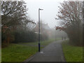
Path to Cawston Grange Drive
Part of the network of paths that wind around Cawston Grange Estate seen here on a murky cold winter afternoon.
Image: © Stephen McKay
Taken: 9 Jan 2021
0.04 miles
2
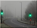
Cawston Grange Drive, Cawston Grange Estate
The green lights of the pelican crossing on Cawston Grange Drive glare through the murk as the freezing fog thickens in the encroaching dusk. In foggy conditions sounds are muted and the Covid-19 lockdown has reduced traffic levels creating an eerie silence on this normally busy road.
Image: © Stephen McKay
Taken: 7 Jan 2021
0.06 miles
3
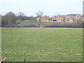
Cawston Grange Estate
The New Housing Development has now spread as far as the Railway Embankment.
Image: © Ian Rob
Taken: 17 Mar 2009
0.14 miles
4

Postbox topper at Cawston
A jubilee-themed topper ('yarn bomb') has appeared on this postbox on Gerard Road. The effort is impressive but the crown does seem to have gone a bit wonky.
Image: © Stephen McKay
Taken: 2 Jun 2022
0.16 miles
5
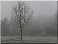
Open space by Cawston Grange Drive
A bare tree seems to emphasise the wintry feel as dusk approaches and the freezing fog gets thicker.
Image: © Stephen McKay
Taken: 7 Jan 2021
0.19 miles
6
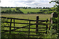
Fields west of Cawston
The gate once gave access for the farmer across the Rugby - Leamington railway, but it has clearly not been used for a long time. The Rugby Western Relief Road will pass across the middle distance.
Image: © Stephen McKay
Taken: 14 Jun 2009
0.19 miles
7
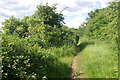
Old railway near Cawston
The trackbed of the old railway between Rugby and Leamington can generally be followed between Bilton and Dunchurch although it is heavily overgrown and very muddy in places. Passenger services ceased as long ago as 1959 although the line remained in use for a daily coal train to Southam Cement Works until 1985.
Image: © Stephen McKay
Taken: 14 Jun 2009
0.19 miles
8

Farmland west of Cawston
This view was taken looking down from the Cawston Greenway (the route of the former Rugby to Leamington railway). The gate leads out onto the A4071 Rugby Western Relief Road.
Image: © Stephen McKay
Taken: 1 Sep 2025
0.20 miles
9
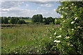
Fields west of Cawston
Seen from the old railway line, across the valley of the Lawford Brook, the wooden fences mark the route of the Rugby Western Relief Road - to be opened later this year.
Image: © Stephen McKay
Taken: 14 Jun 2009
0.22 miles
10

Judith Way, Cawston Grange Estate
The snow on Judith Way seems to be barely disturbed on this Monday morning. The road is named after Judith Boughton an 18th century member of the family that owned the Manor of Cawston.
Image: © Stephen McKay
Taken: 8 Feb 2021
0.24 miles