
IMAGES TAKEN NEAR TO
Barton Road, RUGBY, CV22 7PT
Introduction
This page details the photographs taken nearby to Barton Road, CV22 7PT by members of the Geograph project.
The Geograph project started in 2005 with the aim of publishing, organising and preserving representative images for every square kilometre of Great Britain, Ireland and the Isle of Man.

There are currently over 7.5m images from over14,400 individuals and you can help contribute to the project by visiting https://www.geograph.org.uk
Image Map
Images are licensed for reuse under creativecommons.org/licenses/by-sa/2.0
Notes
- Clicking on the map will re-center to the selected point.
- The higher the marker number, the further away the image location is from the centre of the postcode.
Image Listing (48 Images Found)
Images are licensed for reuse under creativecommons.org/licenses/by-sa/2.0
Image
Details
Distance
1
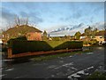
Bilton-Barton Road
At the junction with David Road.
Image: © Ian Rob
Taken: 18 Dec 2011
0.07 miles
2
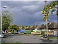
Bilton-Orchard Way
A road made up almost entirely of bungalows built in the 1960s.
Image: © Ian Rob
Taken: 28 Aug 2011
0.08 miles
3
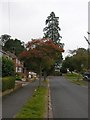
Old Bilton-David Road
A huge Fir tree on the corner of David Road and Selborne Road.
Image: © Ian Rob
Taken: 3 Oct 2007
0.12 miles
4
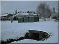
Bilton-Deepmore Road
Two tunnels take the Sow Brook under Deepmore Road.
Image: © Ian Rob
Taken: 6 Jan 2010
0.13 miles
5
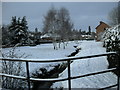
Bilton-Deepmore Road
Snow on the banks of the Sow Brook
Image: © Ian Rob
Taken: 6 Jan 2010
0.14 miles
6
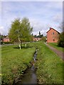
Old Bilton-Deepmore Road
The Sow Brook is the boundary between Old Bilton and Rugby.
Image: © Ian Rob
Taken: 1 May 2008
0.14 miles
7
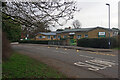
Crescent School, Bilton
Crescent School was founded in 1948 specifically to provide education for the children of Rugby School masters. It was originally located on Horton Crescent in Rugby town centre (close to Rugby School) but moved to these vacant school premises on Bawnmore Road, which were previously occupied by St Mark's Primary School, in 1988. Today the school caters for boys and girls aged 4-11 and is one of two independent schools in the Bilton area (the other is Bilton Grange Preparatory School). Since 2016 the school has been part of the Princethorpe Foundation and now has over 160 pupils. There is an associated day nursery, called Pathfinders, on the site but at the time of this photograph it had just been announced that, due to pressures brought about by the Covid-19 pandemic, that would be closing; Crescent School will take over the building at the end of June 2021 for 'music, the performing arts and after school wrap-around care'.
Compare with Image taken 15 years earlier since when the building has had new windows and signage. Some of the pupils at the school then will now be in their mid twenties.
Image: © Stephen McKay
Taken: 20 Feb 2021
0.15 miles
8
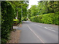
Bilton-Overslade Lane
Looking downhill from near the junction with Bawnmore Road.
Image: © Ian Rob
Taken: 10 May 2009
0.15 miles
9

Bilton-Selborne Road
Open spaces on this 1940s built council estate.
Image: © Ian Rob
Taken: 20 Apr 2011
0.15 miles
10
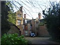
Bilton-Church Walk
Bilton Hall a Grade I listed building dating from 1623. After world war II the mansion was converted into flats.
Image: © Ian Rob
Taken: 24 Feb 2011
0.16 miles