
IMAGES TAKEN NEAR TO
Wheatfield Road, RUGBY, CV22 7LN
Introduction
This page details the photographs taken nearby to Wheatfield Road, CV22 7LN by members of the Geograph project.
The Geograph project started in 2005 with the aim of publishing, organising and preserving representative images for every square kilometre of Great Britain, Ireland and the Isle of Man.

There are currently over 7.5m images from over14,400 individuals and you can help contribute to the project by visiting https://www.geograph.org.uk
Image Map
Images are licensed for reuse under creativecommons.org/licenses/by-sa/2.0
Notes
- Clicking on the map will re-center to the selected point.
- The higher the marker number, the further away the image location is from the centre of the postcode.
Image Listing (31 Images Found)
Images are licensed for reuse under creativecommons.org/licenses/by-sa/2.0
Image
Details
Distance
1
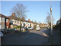
Old Bilton-Wheatfield Road
Semi-Detached housing built as the village expanded in the mid 20th century.
Image: © Ian Rob
Taken: 11 Apr 2008
0.03 miles
2
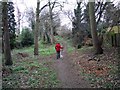
Rugby-Blackwood Avenue
A small Spinney at the rear of Wheatfield Road is popular with dog walkers.
Image: © Ian Rob
Taken: 26 Dec 2011
0.05 miles
3
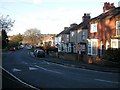
Old Bilton-Addison Road
The main route between Old and New Bilton. Traffic calming measures are in place on the steep hills on this road.
Image: © Ian Rob
Taken: 11 Apr 2008
0.07 miles
4
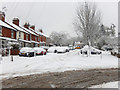
Addison Road, Bilton
Snow may look lovely on Christmas cards but the reality is less attractive. Here, following several hours of heavy snowfall, the Addison Road hill has proved inaccessible to most vehicles and traffic has been forced to turn right into Blackwood Avenue. Some people are attempting to get the orange car moving but it is proving a struggle.
Image: © Stephen McKay
Taken: 10 Dec 2017
0.09 miles
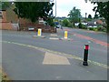
6
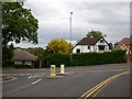
Rugby - Bilton Road
The Junction of Addison Road and Bilton Road.
Image: © Ian Rob
Taken: 28 May 2006
0.10 miles
7
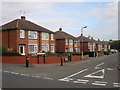
Rugby-Hoods Way
Cul-de-sac of neat semi-detached houses on the Admirals Estate.
Image: © Ian Rob
Taken: 18 Sep 2009
0.11 miles
8
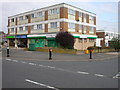
Bilton-Blackwood Avenue
A rundown block of shops with flats up above. The immediate area looks likely to be redeveloped.
Image: © Ian Rob
Taken: 18 Sep 2009
0.13 miles
9
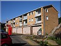
Rugby - Old Bilton
Derelict Shops and Flats in Blackwood Avenue.
Image: © Ian Rob
Taken: 3 Oct 2006
0.13 miles
10
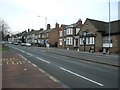
Rugby-Bilton Road
Terraced housing up the hill towards Bilton, with the Crow Pie Public House in the right of the photo. The temperature at midday is between -2 and -3 degrees centigrade.
Image: © Ian Rob
Taken: 4 Jan 2009
0.13 miles