
IMAGES TAKEN NEAR TO
Calvestone Road, RUGBY, CV22 7GH
Introduction
This page details the photographs taken nearby to Calvestone Road, CV22 7GH by members of the Geograph project.
The Geograph project started in 2005 with the aim of publishing, organising and preserving representative images for every square kilometre of Great Britain, Ireland and the Isle of Man.

There are currently over 7.5m images from over14,400 individuals and you can help contribute to the project by visiting https://www.geograph.org.uk
Image Map
Images are licensed for reuse under creativecommons.org/licenses/by-sa/2.0
Notes
- Clicking on the map will re-center to the selected point.
- The higher the marker number, the further away the image location is from the centre of the postcode.
Image Listing (38 Images Found)
Images are licensed for reuse under creativecommons.org/licenses/by-sa/2.0
Image
Details
Distance
1

Cawston Grange Primary School
This school was opened in 2003 to cater for the new Cawston Grange estate. Note the sculptures of children playing; these were made by artist David Gosling depicting various playground games. Compare this school with the nearby Henry Hinde Junior School to see how Warwickshire County Council school architecture has evolved over 30 years: Image .
Image: © Stephen McKay
Taken: 30 Sep 2007
0.08 miles
2
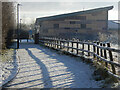
Path on Cawston Grange Estate
This snow covered path provides a convenient route from the western side of the estate to Cawston Grange Primary School. The modern building is Cawston Grange Community Hall.
Image: © Stephen McKay
Taken: 25 Jan 2021
0.11 miles
3
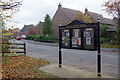
Whitefriars Drive, Cawston Grange Estate
A notice case is provided here by Cawston Parish Council to display council minutes and other community notices. The prominent 'NO' in the central section is a reminder to bag and bin dog waste. When the estate was built, mainly around 2003/4 (although there have been more recent extensions to the south), a decision was taken not to incorporate the area into Rugby town but instead to give it its own civil parish. The Whitefriars name reflects the fact that Cawston Hall was built by the Boughton family out of bricks taken from the demolished Whitefriars Church in Coventry.
Image: © Stephen McKay
Taken: 1 Nov 2020
0.12 miles
4

Cawston Grange Shops
The modern Cawston Grange estate is served by this row of shops comprising a fish and chip shop called Waves, Chinese Chef takeaway, a hairdressers, and a Coop convenience store. Even though this is a Sunday morning, it is unusual to see the car park completely empty.
Image: © Stephen McKay
Taken: 16 Jan 2022
0.13 miles
5
Gerard Road, Cawston Grange Estate
Freezing fog envelops Gerard Road as a figure crosses towards the Co-op food store. The Co-op is part of a small parade of shops that also includes a hairdresser and two food takeaways.
Image: © Stephen McKay
Taken: 7 Jan 2021
0.13 miles
6
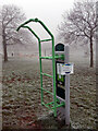
Outdoor gym equipment - Cawston Grange
The grass is covered in frost which was there all day. The notice advises that this piece of equipment is not to be used during the Covid-19 lockdown; nearby children's play equipment, however, could be used in accordance with the regulations in force.
Image: © Stephen McKay
Taken: 7 Jan 2021
0.13 miles
7
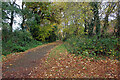
Path on Cawston Grange Estate
The path leads off Whitefriars Drive and is covered in fallen leaves as befits the season.
Image: © Stephen McKay
Taken: 1 Nov 2020
0.13 miles
8
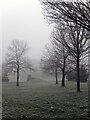
Cawston Play Area
Bare trees and frost covered grass on the edge of the play area.
Image: © Stephen McKay
Taken: 7 Jan 2021
0.14 miles
9
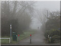
Path on Cawston Grange Estate
A figure looms out of the fog and murk on the morning of New Year's Eve. The path connects Whitefriars Drive with Gerard Road.
Image: © Stephen McKay
Taken: 31 Dec 2020
0.14 miles
10
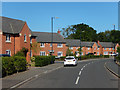
Whitefriars Drive, Cawston Grange
The houses here were built around 2004. They are part of the extensive Cawston Grange estate.
Image: © Stephen McKay
Taken: 28 May 2020
0.14 miles