
IMAGES TAKEN NEAR TO
Firs Drive, RUGBY, CV22 7AD
Introduction
This page details the photographs taken nearby to Firs Drive, CV22 7AD by members of the Geograph project.
The Geograph project started in 2005 with the aim of publishing, organising and preserving representative images for every square kilometre of Great Britain, Ireland and the Isle of Man.

There are currently over 7.5m images from over14,400 individuals and you can help contribute to the project by visiting https://www.geograph.org.uk
Image Map
Images are licensed for reuse under creativecommons.org/licenses/by-sa/2.0
Notes
- Clicking on the map will re-center to the selected point.
- The higher the marker number, the further away the image location is from the centre of the postcode.
Image Listing (258 Images Found)
Images are licensed for reuse under creativecommons.org/licenses/by-sa/2.0
Image
Details
Distance
1

Rugby - East Union Street
The Bradby Club, originally a boys club but now a Youth Club for all.
Image: © Ian Rob
Taken: 21 May 2006
0.01 miles
2
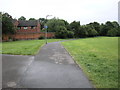
Rugby - East Union Street
The Footpath leading to Overslade.
Image: © Ian Rob
Taken: 27 May 2008
0.01 miles
3
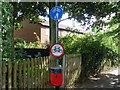
Cycling Signs in Rugby Town Centre
These two cycling signs are on the footpath near Alfred Green Close off Dunchurch Road in Rugby. The blue sign indicates "cycle route for use by cyclists and pedestrians together" whilst the red and white sign indicates "no cycling". From those two signs, it would be difficult to know whether one can or cannot cycle on this footpath.
Image: © David Hillas
Taken: 11 Sep 2010
0.03 miles
4
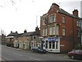
Rugby - Dunchurch Road
Royal Oak Public House (dating from 1907) and short row of terraced houses on corner of East Union Street.
Image: © Ian Rob
Taken: 21 Mar 2006
0.06 miles
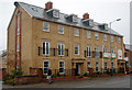
7
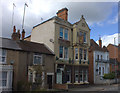
A J Bar and accommodation, Dunchurch Road
Image: © Robert Eva
Taken: 21 Mar 2017
0.08 miles
8
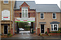
Arched entrance to new block of flats, Dunchurch Road
Image: © Andy F
Taken: 27 Oct 2009
0.08 miles
9
Rugby-Smile House
Offices of the British Dental Health Foundation in East Union Street.
Image: © Ian Rob
Taken: 9 Dec 2012
0.08 miles
10
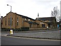
Rugby - Russelsheim Way
Rugby Methodist Centre on Russelsheim Way - named after German twin town.
Image: © Ian Rob
Taken: 21 Mar 2006
0.08 miles