
IMAGES TAKEN NEAR TO
Dunsmore Heath, RUGBY, CV22 6TR
Introduction
This page details the photographs taken nearby to Dunsmore Heath, CV22 6TR by members of the Geograph project.
The Geograph project started in 2005 with the aim of publishing, organising and preserving representative images for every square kilometre of Great Britain, Ireland and the Isle of Man.

There are currently over 7.5m images from over14,400 individuals and you can help contribute to the project by visiting https://www.geograph.org.uk
Image Map
Images are licensed for reuse under creativecommons.org/licenses/by-sa/2.0
Notes
- Clicking on the map will re-center to the selected point.
- The higher the marker number, the further away the image location is from the centre of the postcode.
Image Listing (167 Images Found)
Images are licensed for reuse under creativecommons.org/licenses/by-sa/2.0
Image
Details
Distance
3
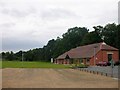
BT repeater station, Dunchurch
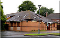
This disused British Telecom repeater station sat (or sits - I haven't been back to check) behind the houses in Adkinson Avenue and Dunsmore Heath and was for sale when the photo was taken. It was two small buildings, on a small plot accessed only by the adjacent public footpath.
Image: © John Brightley
Taken: 26 Sep 2004
0.03 miles
6
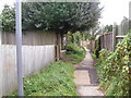
Public footpath, Dunchurch
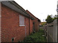
This footpath runs behind the houses in Adkinson Avenue (to the right). The disused BT repeater station seen in Image] is behind the low fence on the left.
Image: © John Brightley
Taken: 26 Sep 2004
0.04 miles
7
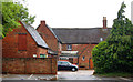
Shop carparking, Dunchurch
A small car park behind shops on the north side of Coventry Road, Dunchurch.
Image: © Andy F
Taken: 7 Jun 2009
0.05 miles
8
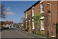
Dunchurch
Looking towards Coventry. This was once the A45 Northampton - Birmingham road, but the village is now by-passed by the M45 to the south.
Image: © Stephen McKay
Taken: 30 Mar 2008
0.05 miles
9

Dunchurch
The Square, looking towards The Dun Cow and crossroads at the centre of the village.
Image: © Stephen McKay
Taken: 30 Mar 2008
0.05 miles
10
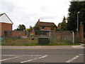
Building plot, Coventry Road, Dunchurch
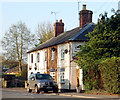
Construction had just started on the foundations for a new house when this photo was taken. On the right can be seen the end of the public footpath which runs behind the houses in Adkinson Avenue.
Image: © John Brightley
Taken: 26 Sep 2004
0.06 miles