
IMAGES TAKEN NEAR TO
Peat Close, RUGBY, CV22 6SA
Introduction
This page details the photographs taken nearby to Peat Close, CV22 6SA by members of the Geograph project.
The Geograph project started in 2005 with the aim of publishing, organising and preserving representative images for every square kilometre of Great Britain, Ireland and the Isle of Man.

There are currently over 7.5m images from over14,400 individuals and you can help contribute to the project by visiting https://www.geograph.org.uk
Image Map
Images are licensed for reuse under creativecommons.org/licenses/by-sa/2.0
Notes
- Clicking on the map will re-center to the selected point.
- The higher the marker number, the further away the image location is from the centre of the postcode.
Image Listing (25 Images Found)
Images are licensed for reuse under creativecommons.org/licenses/by-sa/2.0
Image
Details
Distance
1
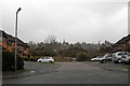
Rugby-Nares Close
Standing on Hudson Road looking towards Bilton Church.The Steel built houses were removed from this part of Overslade in the 1980s and replaced with brick built ones. The semi-detached ones in the mid distance are on Lytham Road and date from the 1940s.
Image: © Ian Rob
Taken: 3 Apr 2012
0.09 miles
2
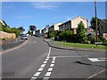
Rugby-Hudson Road
The junction with Marlborough Road on Overslade Estate.
Image: © Ian Rob
Taken: 30 Jul 2008
0.09 miles
3
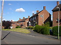
Rugby-Saint Anne's Road
Brick built homes on Overslade Estate.
Image: © Ian Rob
Taken: 15 Jun 2008
0.13 miles
4
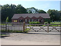
Rugby-Buchanan Road
The Overslade Community Centre, rebuilt after an arson attack in 2005. It is also known as Overslade Church (Church of England).
Image: © Ian Rob
Taken: 9 Aug 2007
0.13 miles
5
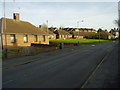
Rugby-Lytham Road
Early evening sunlight on the bungalows for old people.
Image: © Ian Rob
Taken: 24 Feb 2011
0.14 miles
6
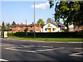
Rugby-Acorn Nursery
Previously a Baptist Church Hall on Bilton Road.The houses next door are former Warwickshire Constabulary Police Houses.
Image: © Ian Rob
Taken: 17 May 2010
0.18 miles
7
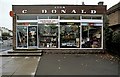
Donald?s on Bilton Road
The local post office and hardware shop on the corner of Bilton Road and Buchanan Road. First stop for stamps, hardware, fishing tackle and Matchbox toys.
Image: © Alan Thomas
Taken: Unknown
0.18 miles
8
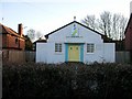
Rugby-Bilton Road
This former Church is now a Pre-school Nursery.
Image: © Ian Rob
Taken: 14 Jan 2007
0.18 miles
10
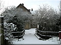
Bilton-Sow Brook
Bridge over the Sow Brook for the footpath into Deepmore Road.
Image: © Ian Rob
Taken: 6 Jan 2010
0.18 miles