
IMAGES TAKEN NEAR TO
Windmill Lane, RUGBY, CV22 6RH
Introduction
This page details the photographs taken nearby to Windmill Lane, CV22 6RH by members of the Geograph project.
The Geograph project started in 2005 with the aim of publishing, organising and preserving representative images for every square kilometre of Great Britain, Ireland and the Isle of Man.

There are currently over 7.5m images from over14,400 individuals and you can help contribute to the project by visiting https://www.geograph.org.uk
Image Map
Images are licensed for reuse under creativecommons.org/licenses/by-sa/2.0
Notes
- Clicking on the map will re-center to the selected point.
- The higher the marker number, the further away the image location is from the centre of the postcode.
Image Listing (31 Images Found)
Images are licensed for reuse under creativecommons.org/licenses/by-sa/2.0
Image
Details
Distance
1

Bend, Windmill Lane, Dunchurch
Looking north-east near Windmill Farm where the lane changes course from north to east.
Image: © Andy F
Taken: 8 May 2009
0.03 miles
2
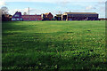
Windmill Farm
Buildings belonging to Windmill Farm can be seen across the field with Windmill Cottages to the left. There is no windmill here now but there are records of a 16th century mill on the 'West Heath' at Dunchurch that ceased operation in the late 18th century. The exact location is believed to have been 200 metres west of the farm, see https://www.ourwarwickshire.org.uk/content/catalogue_her/post-medieval-windmill-200m-w-of-windmill-farm
Image: © Stephen McKay
Taken: 12 Nov 2020
0.04 miles
3

Dunchurch-Windmill Farm
Farming machinery on Windmill Lane.
Image: © Ian Rob
Taken: 31 May 2008
0.05 miles
4

Sheep at Windmill Farm
Electric fence equipment can be seen in the foreground. Under current plans the land here is designated for housing development.
Image: © Stephen McKay
Taken: 12 Nov 2020
0.07 miles
5

Cattle near Windmill Farm, Dunchurch
Looking south-west near the bend in Windmill Lane.
Image: © Andy F
Taken: 8 May 2009
0.08 miles
6
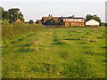
Dunchurch-Windmill Farm
Approaching the farm on the path from Cawston Wood.
Image: © Ian Rob
Taken: 29 Aug 2007
0.08 miles
7

Track to Cawston Lane
In effect an extension of Windmill Lane, this track leads through to the junction of Cawston Lane and Northampton Lane; it is a public right of way. On the right is a muck spreader that has definitely seen better days.
Image: © Stephen McKay
Taken: 12 Nov 2020
0.08 miles
8

Windmill Lane, unmetalled section
Looking east from near Windmill Farm.
Image: © Andy F
Taken: 8 May 2009
0.10 miles

10

Dunchurch Footpath
From Windmill Farm to Coventry Road.
Image: © Ian Rob
Taken: 15 Aug 2010
0.10 miles