
IMAGES TAKEN NEAR TO
Ecton Leys, RUGBY, CV22 5SL
Introduction
This page details the photographs taken nearby to Ecton Leys, CV22 5SL by members of the Geograph project.
The Geograph project started in 2005 with the aim of publishing, organising and preserving representative images for every square kilometre of Great Britain, Ireland and the Isle of Man.

There are currently over 7.5m images from over14,400 individuals and you can help contribute to the project by visiting https://www.geograph.org.uk
Image Map
Images are licensed for reuse under creativecommons.org/licenses/by-sa/2.0
Notes
- Clicking on the map will re-center to the selected point.
- The higher the marker number, the further away the image location is from the centre of the postcode.
Image Listing (7 Images Found)
Images are licensed for reuse under creativecommons.org/licenses/by-sa/2.0
Image
Details
Distance
1
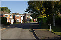
Ecton Leys, Hillside
Short cul-de-sac on the edge of the estate.
Image: © Stephen McKay
Taken: 12 Oct 2008
0.03 miles
2
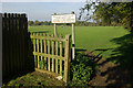
Rokeby Sports Ground
11.3 acre site providing mainly football pitches between Long Furlong and Fawsley Leys.
Image: © Stephen McKay
Taken: 12 Oct 2008
0.04 miles
3
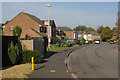
Norton Leys, Hillside
Norton Leys curls round the Hillside Estate; most, but not all, roads leading off it are also 'leys'.
Image: © Stephen McKay
Taken: 12 Oct 2008
0.08 miles
4
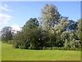
Rugby-Rokeby
Trees and bushes conceal the pond in the corner of the Playing Field.
Image: © Ian Rob
Taken: 6 Aug 2007
0.14 miles
5
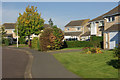
Orson Leys, Hillside
Immaculately kept front gardens on this quiet estate to the south of Rugby town centre.
Image: © Stephen McKay
Taken: 12 Oct 2008
0.15 miles
6
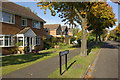
Drayton Leys, Hillside
Seen from the junction with Orson Leys.
Image: © Stephen McKay
Taken: 12 Oct 2008
0.15 miles
7
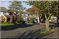
Long Furlong, Hillside
Leafy street connecting the Hillside and Rokeby estates.
Image: © Stephen McKay
Taken: 12 Oct 2008
0.25 miles