IMAGES TAKEN NEAR TO
Warwick Way, RUGBY, CV22 5SF
Introduction
This page details the photographs taken nearby to Warwick Way, CV22 5SF by members of the Geograph project.
The Geograph project started in 2005 with the aim of publishing, organising and preserving representative images for every square kilometre of Great Britain, Ireland and the Isle of Man.

There are currently over 7.5m images from over14,400 individuals and you can help contribute to the project by visiting https://www.geograph.org.uk
Image Map
Images are licensed for reuse under creativecommons.org/licenses/by-sa/2.0
Notes
- Clicking on the map will re-center to the selected point.
- The higher the marker number, the further away the image location is from the centre of the postcode.
Image Listing (17 Images Found)
Images are licensed for reuse under creativecommons.org/licenses/by-sa/2.0
Image
Details
Distance
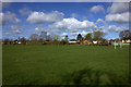
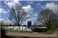
1
Hillmorton-Ashlawn School
The Comprehensive school for the east side of Rugby. The buildings in the photo are the former Dunsmore School for Girls.
Image: © Ian Rob
Taken: 6 Sep 2009
0.07 miles
2
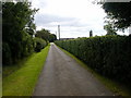
Hillmorton - Ridgeway Farm
The private Road to Ridgeway Farm.
Image: © Ian Rob
Taken: 6 Sep 2009
0.07 miles
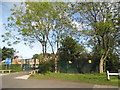
3
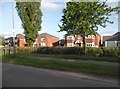
Brand new houses on Ashlawn Road, Hillmorton
These were less than a year old when taken and built on agricultural land which was The Ridgeway Farm.
Image: © David Howard
Taken: 21 May 2017
0.08 miles
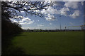
4
Little Morton development site
Ashlawn Road, Rugby
Image: © Robert Eva
Taken: 21 Mar 2017
0.09 miles
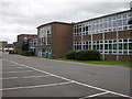
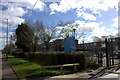
5
The entrance to Ashlawn School, Hillmorton
The expressive arts and sixth form centre.
Image: © David Howard
Taken: 21 May 2017
0.13 miles
8
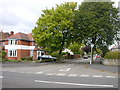
Hillmorton-Charter Road
At the junction with Ashlawn Road.
Image: © Ian Rob
Taken: 6 Sep 2009
0.16 miles
9
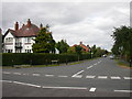
Hillmorton-Fisher Avenue
Part of the Paddox Estate built in the 1930s.Showing the junction with Ashlawn Road.
Image: © Ian Rob
Taken: 6 Sep 2009
0.16 miles