
IMAGES TAKEN NEAR TO
Roseberry Avenue, COVENTRY, CV2 1UT
Introduction
This page details the photographs taken nearby to Roseberry Avenue, CV2 1UT by members of the Geograph project.
The Geograph project started in 2005 with the aim of publishing, organising and preserving representative images for every square kilometre of Great Britain, Ireland and the Isle of Man.

There are currently over 7.5m images from over14,400 individuals and you can help contribute to the project by visiting https://www.geograph.org.uk
Image Map
Images are licensed for reuse under creativecommons.org/licenses/by-sa/2.0
Notes
- Clicking on the map will re-center to the selected point.
- The higher the marker number, the further away the image location is from the centre of the postcode.
Image Listing (63 Images Found)
Images are licensed for reuse under creativecommons.org/licenses/by-sa/2.0
Image
Details
Distance
1
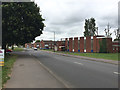
North end of Roseberry Avenue, Hall Green, north Coventry
Almond Tree Avenue joins, left, and continues north. The building on the right is Hall Green Methodist Church. The sign at the left edge directs to 'Spirit Quarters – new 2, 3 and 4-bedroomed homes' by a developer called Keepmoat.
Image: © Robin Stott
Taken: 11 Jul 2016
0.02 miles
2
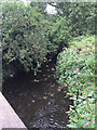
River Sowe downstream from Roseberry Avenue, Bell Green, north Coventry
Image: © Robin Stott
Taken: 11 Jul 2016
0.03 miles
3
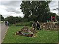
Walking past Bell Green play area, near Roseberry Avenue, north Coventry
The play area was opened in 2010. The boy on the bike is crossing the River Sowe. The fingerpost indicates the Sowe Valley footpath.
Image: © Robin Stott
Taken: 11 Jul 2016
0.04 miles
4
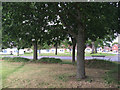
Single-storey dwellings by Almond Tree Avenue, Hall Green, north Coventry
Image: © Robin Stott
Taken: 11 Jul 2016
0.05 miles
5
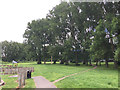
Open space with big poplars, Bell Green, north Coventry
Image: © Robin Stott
Taken: 11 Jul 2016
0.06 miles
6
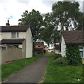
Footpath between houses, off Almond Tree Avenue, Hall Green, north Coventry
Image: © Robin Stott
Taken: 11 Jul 2016
0.06 miles
7
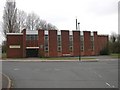
Coventry - Wood End
Hall Green Methodist Church on Almond Tree Avenue.
Image: © Ian Rob
Taken: 15 Apr 2006
0.07 miles
8
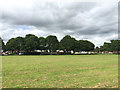
Open space by Almond Tree Avenue, Hall Green, north Coventry
The River Sowe is behind the camera. Much of its floodplain through Coventry's suburbs is public open space managed in a variety of ways.
Image: © Robin Stott
Taken: 11 Jul 2016
0.07 miles
9
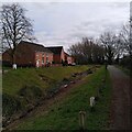
Sowe Valley Footpath and drainage ditch, Wood End
To the right of the path, not visible in the photo, runs a small stream, a tributary of the River Sowe that flows out of Wyken Pool and joins the Sowe among the trees in the distance. To the left of the drainage ditch are houses of a recent 'regeneration' development in Wood End with the odd name of 'Spirit Quarters', which suggests haunted houses.
Image: © A J Paxton
Taken: 19 Mar 2023
0.08 miles
10
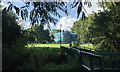
Refurbishment of flats off Cherrybrook Way, Bell Green, north Coventry
The view is across the River Sowe from Squirrel Close, Wood End.
Image: © Robin Stott
Taken: 2 Oct 2016
0.08 miles