
IMAGES TAKEN NEAR TO
Old Crown Mews, COVENTRY, CV2 1RN
Introduction
This page details the photographs taken nearby to Old Crown Mews, CV2 1RN by members of the Geograph project.
The Geograph project started in 2005 with the aim of publishing, organising and preserving representative images for every square kilometre of Great Britain, Ireland and the Isle of Man.

There are currently over 7.5m images from over14,400 individuals and you can help contribute to the project by visiting https://www.geograph.org.uk
Image Map
Images are licensed for reuse under creativecommons.org/licenses/by-sa/2.0
Notes
- Clicking on the map will re-center to the selected point.
- The higher the marker number, the further away the image location is from the centre of the postcode.
Image Listing (51 Images Found)
Images are licensed for reuse under creativecommons.org/licenses/by-sa/2.0
Image
Details
Distance
1
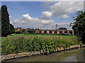
Canalside farmland south-east of Hawkesbury in Warwickshire
This view is from the Oxford Canal, looking north-east towards the housing in Old Crown News, off Lenton's Lane.
Image: © Roger D Kidd
Taken: 20 Aug 2013
0.05 miles
2
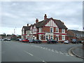
The Old Crown public house, Hawkesbury
On Alderman's Green Road.
Image: © JThomas
Taken: 4 Mar 2017
0.05 miles
4
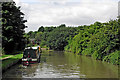
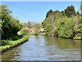
Oxford Canal south-east of Hawkesbury in Warwickshire
This is the Oxford Canal, looking west towards Tusses Bridge, No 4.
Image: © Roger D Kidd
Taken: 20 Aug 2013
0.06 miles
5
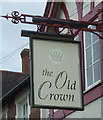
Sign for the Old Crown public house, Hawkesbury
Image: © JThomas
Taken: 4 Mar 2017
0.06 miles
6
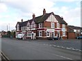
Hawkesbury, Old Crown
Pub at the junction of Alderman's Green Road and Lentons Lane; bar right, eating and drinking areas left, garden, background music, games machines; no cask ale available.
Image: © Mike Faherty
Taken: 6 Feb 2015
0.07 miles
8
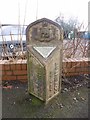
Old Boundary Marker by the B4109, Parrotts Grove
Parish Boundary Marker by the B4109, in parish of Coventry (Coventry District), Parrotts Grove, 100m N junction with Lenton's Lane against low wall.
Inscription reads:- : URBAN DISTRICT / OF / BEDWORTH : : CITY OF / COVENTRY :
Surveyed
Milestone Society National ID: WA_COVBD4pb.
Image: © Milestone Society
Taken: Unknown
0.09 miles
9
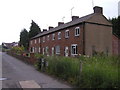
416 to 426 Alderman's Green Road, Coventry
This row of cottages are a rare survivor of many similar workers cottages built in the area in the 19th century - perhaps in the 1830's to 1850's. Most others have, like others which used to exist all along this road - been demolished for redevelopment, or altered beyond recognition. Even this row has new pvc windows.
The three cottages at the far end have been empty for many years - I believe they are owned by the haulage firm whose premises lie behind.
The patterned brickwork is a very distinctive Warwickshire trademark - I believe the stretcher bricks are a different colour to the headers simply because the ends of the bricks have been fired less than the sides.
Image: © John Brightley
Taken: 8 Jun 2003
0.09 miles
10
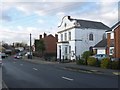
Hawkesbury, Lentons Lane Baptist Chapel
According to inscriptions, once known as Zion Baptist Chapel, with dates from 1845 and 1921.
Image: © Mike Faherty
Taken: 6 Feb 2015
0.09 miles