
IMAGES TAKEN NEAR TO
Roseberry Avenue, COVENTRY, CV2 1ND
Introduction
This page details the photographs taken nearby to Roseberry Avenue, CV2 1ND by members of the Geograph project.
The Geograph project started in 2005 with the aim of publishing, organising and preserving representative images for every square kilometre of Great Britain, Ireland and the Isle of Man.

There are currently over 7.5m images from over14,400 individuals and you can help contribute to the project by visiting https://www.geograph.org.uk
Image Map
Images are licensed for reuse under creativecommons.org/licenses/by-sa/2.0
Notes
- Clicking on the map will re-center to the selected point.
- The higher the marker number, the further away the image location is from the centre of the postcode.
Image Listing (63 Images Found)
Images are licensed for reuse under creativecommons.org/licenses/by-sa/2.0
Image
Details
Distance
1
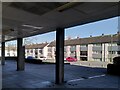
Roseberry Avenue flats, viewed from underneath Samuel Hayward House
This is a view of three-storey blocks of flats on Roseberry Avenue, on the Bell Green estate in Coventry, seen from underneath Samuel Hayward House in Riley Square Image The flats face towards Riley Square and the road and back onto the open green spaces of the Sowe Valley floodplain. Modern Bell Green was built by Coventry Corporation in the 1950s and 60s to the designs of the city architect Donald Gibson and his successor Arthur Ling.
Image: © A J Paxton
Taken: 7 Apr 2023
0.01 miles
2
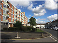
Flats either side of Roseberry Avenue, Bell Green, north Coventry
Samuel Hayward House is on the left. The view is from the turning for the Riley Square car parks Image
Image: © Robin Stott
Taken: 2 Oct 2016
0.02 miles
3
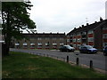
Council flats, Roseberry Avenue, Bell Green
Image: © John Brightley
Taken: 25 May 2010
0.02 miles
4
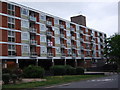
Samuel Hayward House, Roseberry Avenue, Bell Green
Council flats, part of the Riley Square development.
Image: © John Brightley
Taken: 25 May 2010
0.03 miles
5
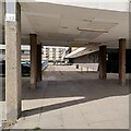
View under Samuel Hayward House of Riley Square and Alice Arnold House
This is a view underneath Samuel Hayward House Image], where it straddles the south-eastern entrance to Riley Square on pilotis or pillars. In the far distance, across the shopping precinct, can be seen a similar block of council flats over shops, Alice Arnold House. It is named after the first woman to become mayor of Coventry, in 1937. Born into poverty in the city workhouse, Arnold worked in factories from the age of 11, became a trade union organiser, then an independent Labour councillor on the city council; see Wikipedia https://en.wikipedia.org/wiki/Alice_Arnold_(mayor) .
To the left, behind the parked cars, is the base of the 17-storey housing block Dewis House. To the right is a supermarket building, now occupied by Farmfoods, with a Polish food shop beyond. It was built by Sainsburys in 1969 and occupied by them for twenty years; see the Sainsburys Archive site, which includes historic photos of Riley Square https://sainsburyarchive.org.uk/catalogue/search/branch/ref/p1127-coventry-bell-green-riley-square-1969-1989-sainsburys-branch/view_as/list . For more on Riley Square see Image
Image: © A J Paxton
Taken: 25 Mar 2023
0.03 miles
6
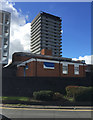
The Samuel Hayward Day Centre, Riley Square, Bell Green, north Coventry
Dewis House, the centrepiece of Riley Square, is in the background. The view is from Roseberry Avenue.
Image: © Robin Stott
Taken: 2 Oct 2016
0.04 miles
7
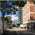
Access to car parks, Riley Square, Bell Green, north Coventry
A turning off Roseberry Avenue. On the right is the corner of Samuel Hayward House flats, with the corner of Dewis House, a multistorey block of flats, centre.
Image: © Robin Stott
Taken: 2 Oct 2016
0.06 miles
8
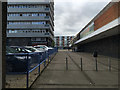
Walkway by Farm Foods, Riley Square, Bell Green, north Coventry
Flats on Roseberry Avenue are just behind the camera. The tower block, Dewis House, is on the left.
Image: © Robin Stott
Taken: 11 Jul 2016
0.06 miles
9
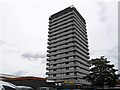
Coventry Bell Green
Dewis House Tower Block in Riley Square.
Image: © Ian Rob
Taken: 26 Jul 2013
0.07 miles
10
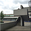
Form follows function ? exterior staircase, Riley Square, Bell Green, north Coventry
Image: © Robin Stott
Taken: 11 Jul 2016
0.07 miles