
IMAGES TAKEN NEAR TO
Pailton Close, COVENTRY, CV2 1GP
Introduction
This page details the photographs taken nearby to Pailton Close, CV2 1GP by members of the Geograph project.
The Geograph project started in 2005 with the aim of publishing, organising and preserving representative images for every square kilometre of Great Britain, Ireland and the Isle of Man.

There are currently over 7.5m images from over14,400 individuals and you can help contribute to the project by visiting https://www.geograph.org.uk
Image Map
Images are licensed for reuse under creativecommons.org/licenses/by-sa/2.0
Notes
- Clicking on the map will re-center to the selected point.
- The higher the marker number, the further away the image location is from the centre of the postcode.
Image Listing (10 Images Found)
Images are licensed for reuse under creativecommons.org/licenses/by-sa/2.0
Image
Details
Distance
4
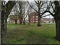
Wood End apartments, Miners Way
Seen through trees at the elbow of Eburne Road and Dutton Road, this pair of apartment blocks frames the entrance to Miners Way in Wood End. With their pitched roofs and brick facades they are clearly modern 'apartments' rather than older council 'flats', part of the 'regeneration' of Wood End, but they lack the balconies of the former Coventry Corporation council flats in Wood End and Bell Green, which perhaps accounts for their rather gaunt appearance.
Image: © A J Paxton
Taken: 19 Mar 2023
0.13 miles
5
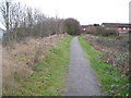
Coventry: Former Wyken Mineral Branch Railway, Wood End
Now a public footpath, between the Aldermans Green Industrial Estate to the left and the houses of Wood End to the right, this was once the route of a short-lived branch line railway that ran to the Alexandra Colliery from the Wyken Colliery. After the Wyken Colliery was worked out by about 1881 the existing railway to it was extended to the Alexandra Colliery, and seems to have remained in use until that colliery was worked out by about 1919.
Image: © Nigel Cox
Taken: 31 Dec 2011
0.14 miles
8
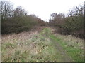
Coventry: Former Wyken Mineral Branch Railway
Now a public footpath, with the Aldermans Green Industrial Estate to the right, this was once the route of a short-lived branch line railway that ran to the Alexandra Colliery from the Wyken Colliery. After the Wyken Colliery was worked out by about 1881 the existing railway to it was extended to the Alexandra Colliery, and seems to have remained in use until that colliery was worked out by about 1919. In this view the site of the old Wyken Colliery is about 300 metres further up the track.
Image: © Nigel Cox
Taken: 31 Dec 2011
0.19 miles
9
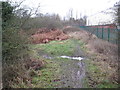
Coventry: Former Wyken Mineral Branch Railway
Now a public footpath, with the Aldermans Green Industrial Estate to the right, this was once the route of a short-lived branch line railway that ran to the Alexandra Colliery from the Wyken Colliery. After the Wyken Colliery was worked out by about 1881 the existing railway to it was extended to the Alexandra Colliery, and seems to have remained in use until that colliery was worked out by about 1919. In this view the site of the old Wyken Colliery is about 200 metres further up the track.
Image: © Nigel Cox
Taken: 31 Dec 2011
0.23 miles
10
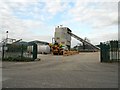
Coventry-Alderman's Green Industrial Estate
A ready mix concrete supplier on Barlow Road.
Image: © Ian Rob
Taken: 16 May 2012
0.23 miles