IMAGES TAKEN NEAR TO
Dering Close, COVENTRY, CV2 1EJ

Introduction

This page details the photographs taken nearby to Dering Close, CV2 1EJ by members of the Geograph project.

The Geograph project started in 2005 with the aim of publishing, organising and preserving representative images for every square kilometre of Great Britain, Ireland and the Isle of Man.

There are currently over 7.5m images from over14,400 individuals and you can help contribute to the project by visiting https://www.geograph.org.uk

Image Map


Images are licensed for reuse under creativecommons.org/licenses/by-sa/2.0
Notes
  • Clicking on the map will re-center to the selected point.
  • The higher the marker number, the further away the image location is from the centre of the postcode.

Image Listing (9 Images Found)

Images are licensed for reuse under creativecommons.org/licenses/by-sa/2.0
Image
Details
Distance
1
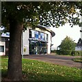
Moat House Leisure & Neighbourhood Centre, Wood End
The centre is a sports, leisure and community centre in Wood End, Coventry, which opened in 2009.
Image: © A J Paxton Taken: 9 Oct 2022
0.08 miles
2
Deedmore Road
Looking south west.
Image: © JThomas Taken: 4 Mar 2017
0.10 miles
3
Houses on Pettor Crescent
Image: © JThomas Taken: 4 Mar 2017
0.11 miles
4
Deedmore Road
Modern housing stock on Deedmore Road, Coventry.
Image: © Peter Mackenzie Taken: 27 Jul 2017
0.11 miles
5
Henley Road
These houses are set well back from Henley Road which is the B4082. Along the road is an eclectic mix of houses.
Image: © Malcolm Neal Taken: 29 Sep 2017
0.15 miles
6
Spirit Quarters, new development
Image: © Alex McGregor Taken: 13 Jan 2015
0.15 miles
7
Moat House campus
Moat House and Castle Wood schools share this campus.
Image: © Peter Mackenzie Taken: 27 Jul 2017
0.20 miles
8
Spirit Quarters, new development
Image: © Alex McGregor Taken: 13 Jan 2015
0.20 miles
9
Henley College
Further Education College on the North side of Coventry.
Image: © Kevin Croucher Taken: 13 Jun 2005
0.22 miles