
IMAGES TAKEN NEAR TO
Clennon Rise, COVENTRY, CV2 1DS
Introduction
This page details the photographs taken nearby to Clennon Rise, CV2 1DS by members of the Geograph project.
The Geograph project started in 2005 with the aim of publishing, organising and preserving representative images for every square kilometre of Great Britain, Ireland and the Isle of Man.

There are currently over 7.5m images from over14,400 individuals and you can help contribute to the project by visiting https://www.geograph.org.uk
Image Map
Images are licensed for reuse under creativecommons.org/licenses/by-sa/2.0
Notes
- Clicking on the map will re-center to the selected point.
- The higher the marker number, the further away the image location is from the centre of the postcode.
Image Listing (6 Images Found)
Images are licensed for reuse under creativecommons.org/licenses/by-sa/2.0
Image
Details
Distance
1
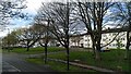
Flats on Widdecombe Close seen from Henley Road
These housing blocks form part of the Manor Farm estate, designed by Coventry City Architect Donald Gibson and his team: see Image
Image: © A J Paxton
Taken: 23 Mar 2024
0.20 miles
2
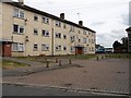
Henley Green Flats
Typicalof the surrounding area, on Widdecombe Close off Henley Road.
Image: © Ian Rob
Taken: 26 Jul 2013
0.21 miles
3
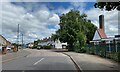
North on Broad Park Road, Coventry
The turning on the right is Logan Road. The chimney probably belongs to Broad Park House. A report from 2019 explains that the Centre there provides short breaks for young disabled children https://www.coventrytelegraph.net/news/coventry-news/short-breaks-disabled-children-set-17333222
Image: © Robin Stott
Taken: 8 Jun 2022
0.23 miles
4
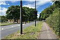
West on Henley Road, Coventry
On the left is the boundary to Manor Farmhouse Image The turning on the right is Broad Park Road Image
Image: © Robin Stott
Taken: 8 Jun 2022
0.23 miles
5
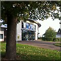
Moat House Leisure & Neighbourhood Centre, Wood End
The centre is a sports, leisure and community centre in Wood End, Coventry, which opened in 2009.
Image: © A J Paxton
Taken: 9 Oct 2022
0.23 miles
6
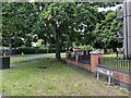
Henley Road, Henley Green, Coventry
Leafy Henley Road east of the junction with Broad Park Road. To the right is a block of 12 flats, Wyatt House.
Image: © Robin Stott
Taken: 8 Jun 2022
0.24 miles