
IMAGES TAKEN NEAR TO
Gibson Drive, RUGBY, CV21 4LL
Introduction
This page details the photographs taken nearby to Gibson Drive, CV21 4LL by members of the Geograph project.
The Geograph project started in 2005 with the aim of publishing, organising and preserving representative images for every square kilometre of Great Britain, Ireland and the Isle of Man.

There are currently over 7.5m images from over14,400 individuals and you can help contribute to the project by visiting https://www.geograph.org.uk
Image Map
Images are licensed for reuse under creativecommons.org/licenses/by-sa/2.0
Notes
- Clicking on the map will re-center to the selected point.
- The higher the marker number, the further away the image location is from the centre of the postcode.
Image Listing (12 Images Found)
Images are licensed for reuse under creativecommons.org/licenses/by-sa/2.0
Image
Details
Distance
4
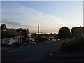
Summer Solstice-Daybreak in Hillmorton
The longest day of the year, looking towards a distant mist filled valley at 05-30 am.
Image: © Ian Rob
Taken: 20 Jun 2012
0.20 miles
5
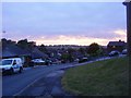
Hillmorton-Coton Road
Sunrise at 05-30 on an overcast and rainy morning.
Image: © Ian Rob
Taken: 4 Aug 2011
0.21 miles
6
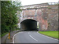
Hillmorton-The Kent
The road from Hillmorton to Clifton passes under the West Coast mainline.Clifton Brook flows under another arch and is prone to flooding hence the raised footpath.
Image: © Ian Rob
Taken: 8 Aug 2010
0.21 miles
7
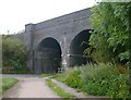
Rugby-West Coast Mainline
Looking from Hillmorton Lane.
Image: © Ian Rob
Taken: 8 Aug 2010
0.21 miles
9
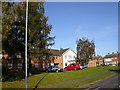
Rugby - Hillmorton
Abbottsbury Old People's Home in Pettifer Crescent.
Image: © Ian Rob
Taken: 29 Oct 2006
0.23 miles
10
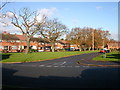
Hillmorton-Abbotts Farm
Phipps Avenue, part of this Council Estate, built in the 1950s.
Image: © Ian Rob
Taken: 29 Nov 2007
0.24 miles