
IMAGES TAKEN NEAR TO
Parkfield Road, RUGBY, CV21 1AT
Introduction
This page details the photographs taken nearby to Parkfield Road, CV21 1AT by members of the Geograph project.
The Geograph project started in 2005 with the aim of publishing, organising and preserving representative images for every square kilometre of Great Britain, Ireland and the Isle of Man.

There are currently over 7.5m images from over14,400 individuals and you can help contribute to the project by visiting https://www.geograph.org.uk
Image Map
Images are licensed for reuse under creativecommons.org/licenses/by-sa/2.0
Notes
- Clicking on the map will re-center to the selected point.
- The higher the marker number, the further away the image location is from the centre of the postcode.
Image Listing (65 Images Found)
Images are licensed for reuse under creativecommons.org/licenses/by-sa/2.0
Image
Details
Distance
1

Rugby Western Relief Road
A traffic island built in anticipation of the Climafuel waste processing plant to be built next to the cement works.
Image: © Ian Rob
Taken: 29 Apr 2011
0.07 miles
2

Rugby - New Bilton
Rugby-Birmingham railway splits over Parkfield Road, the lower bridge is outgoing from Rugby and higher one is incoming. There is a junction with west coast mainline about a quarter of a mile east of this point.
Image: © Ian Rob
Taken: 25 Apr 2006
0.09 miles
3

Rugby Western Relief Road
The northern section between New Bilton and Newbold was finally opened this week, almost a year late. The former Parkfield Road is now the A4071 and passes under the Rugby-Birmingham Railway at this point.
Image: © Ian Rob
Taken: 12 Sep 2010
0.09 miles
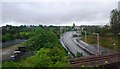
5

Rugby-Malpass Farm Site
Work has begun on the Climafuel Waste Disposal Plant which will provide fuel for the nearby Cemex Cement Works.
Image: © Ian Rob
Taken: 4 May 2014
0.11 miles
6
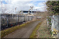
Footpath around the old quarry
The footpath passes around the north side of the old quarry pit beside the Rugby - Coventry railway. The security fencing prevents access either to railway property or the dangerous edge of the quarry, but it hardly makes for an attractive walk. The large warehouse is occupied by Rugby Self Store which offers 'self storage solutions for both domestic and commercial customers in Rugby and the surrounding areas' - apparently the only one of its kind in the region.
Image: © Stephen McKay
Taken: 15 Mar 2021
0.12 miles
7

Rugby-Malpass Farm Site
The site of Malpass Farm Quarry has been approved by the County Council for the construction of a Climafuel plant which will produce fuel from waste products for the nearby Cement Works.Permission was granted last week but the beginnings of an access road from the Western Relief Road already appears to be in place.
Image: © Ian Rob
Taken: 21 Nov 2009
0.12 miles
8

Newbold-Parkfield Road
New bridge carrying the Western Relief Road over the West Coast Mainline.Avon Valley School can be seen in the right of the photograph.
Image: © Ian Rob
Taken: 21 Nov 2009
0.12 miles
9

Parkfield Road, New Bilton
Parkfield Road forms part of the A4071 Rugby Western Relief Road around the western side of the town. Although this section existed previously as a minor road, the relief road was opened as a through route in 2010. Here it threads its way between an old quarry and Rugby Cement Works.
Image: © Stephen McKay
Taken: 15 Mar 2021
0.13 miles
10

Cemex works, Rugby
A view looking south over the Cemex factory/plant,Taken from one of the spoil heaps created by the excavation of Malpass quarry
Image: © Aaron Sutcliffe
Taken: 21 Jan 2010
0.13 miles