IMAGES TAKEN NEAR TO
Hornsey Rise, NUNEATON, CV13 6DF
Introduction
This page details the photographs taken nearby to Hornsey Rise, CV13 6DF by members of the Geograph project.
The Geograph project started in 2005 with the aim of publishing, organising and preserving representative images for every square kilometre of Great Britain, Ireland and the Isle of Man.

There are currently over 7.5m images from over14,400 individuals and you can help contribute to the project by visiting https://www.geograph.org.uk
Image Map (Loading...)


Getting Data...Please wait
Leaflet Map data © OpenStreetMap
Images are licensed for reuse under creativecommons.org/licenses/by-sa/2.0
Notes
- Clicking on the map will re-center to the selected point.
- The higher the marker number, the further away the image location is from the centre of the postcode.
Image Listing (12 Images Found)
Images are licensed for reuse under creativecommons.org/licenses/by-sa/2.0
Image
Details
Distance
1
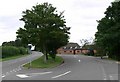
Temple Hall Farm along Bosworth Road
At Wellsborough in West Leicestershire.
Image: © Mat Fascione
Taken: 3 Aug 2008
0.15 miles
2
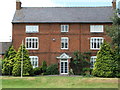
Temple Hall, Wellsborough
Temple Hall - formerly a farm now home to Dixie Grammar Junior School on B585 near Market Bosworth
Image: © David Barnes
Taken: 26 Jun 2005
0.15 miles
3
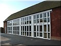
Wellsborough - Barn converted to classrooms
Barn conversion with a difference - this has become an eight room two-story classroom block, part of The Dixie Grammar Junior School
Image: © David Barnes
Taken: 26 Aug 2005
0.15 miles
4
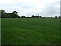
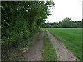
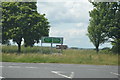
Crop field near Wellsborough
Just north of Tinsel Lane.
Image: © JThomas
Taken: 23 May 2015
0.16 miles