
IMAGES TAKEN NEAR TO
Twenty Acre Lane, NUNEATON, CV13 0AJ
Introduction
This page details the photographs taken nearby to Twenty Acre Lane, CV13 0AJ by members of the Geograph project.
The Geograph project started in 2005 with the aim of publishing, organising and preserving representative images for every square kilometre of Great Britain, Ireland and the Isle of Man.

There are currently over 7.5m images from over14,400 individuals and you can help contribute to the project by visiting https://www.geograph.org.uk
Image Map
Images are licensed for reuse under creativecommons.org/licenses/by-sa/2.0
Notes
- Clicking on the map will re-center to the selected point.
- The higher the marker number, the further away the image location is from the centre of the postcode.
Image Listing (62 Images Found)
Images are licensed for reuse under creativecommons.org/licenses/by-sa/2.0
Image
Details
Distance
1
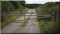
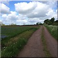
Track with gate at Sutton Cheney
The guard cat is on duty!
Image: © John Welford
Taken: 24 Aug 2015
0.06 miles
2
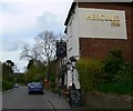
Hercules Inn, Sutton Cheney
Looking north along Main Street.
Image: © Mat Fascione
Taken: 3 May 2009
0.10 miles
4
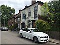
Hercules Revived
Previously called the Hercules Inn (the name taken from an 18th century racehorse). I should think the new name indicates new management, possibly the pub was closed for some time? It was last geographed as the Hercules Inn in 2009 Image
It served us some lovely fish and chips for lunch!
Image: © Graham Hogg
Taken: 2 Jun 2018
0.11 miles
6
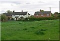
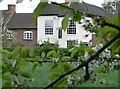
Houses in Sutton Cheney, Leicestershire
Image: © Mat Fascione
Taken: 3 May 2009
0.13 miles
7
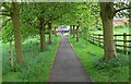
Path from the church
Looking from the churchyard of Saint James Church towards the Main Street of Sutton Cheney.
Image: © Mat Fascione
Taken: 3 May 2009
0.14 miles
8
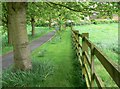
Path from the church
Looking from the churchyard of Saint James Church towards the Main Street of Sutton Cheney.
Image: © Mat Fascione
Taken: 3 May 2009
0.14 miles
9
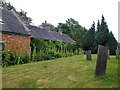
Almshouses at Sutton Cheney
A row of ivy-covered almshouses, on the SE side of the churchyard. Pevsner, in the Leicestershire volume of 'The Buildings of England', says almshouses were first built here in the early 1600's, though the buildings now on the site date from the 18th century.
It seems to me that in the Midland counties almshouses (sometimes known as 'bedehouses') often outlast their more substantial neighbours, to become some of the oldest dwellings in a village.
Image: © Stefan Czapski
Taken: 7 Jul 2010
0.14 miles
10
Information Board, Church of St James, Sutton Cheney, Leicestershire
Image: © Christine Matthews
Taken: 12 Sep 2012
0.15 miles