
IMAGES TAKEN NEAR TO
Coalpit Fields Road, BEDWORTH, CV12 9HW
Introduction
This page details the photographs taken nearby to Coalpit Fields Road, CV12 9HW by members of the Geograph project.
The Geograph project started in 2005 with the aim of publishing, organising and preserving representative images for every square kilometre of Great Britain, Ireland and the Isle of Man.

There are currently over 7.5m images from over14,400 individuals and you can help contribute to the project by visiting https://www.geograph.org.uk
Image Map
Images are licensed for reuse under creativecommons.org/licenses/by-sa/2.0
Notes
- Clicking on the map will re-center to the selected point.
- The higher the marker number, the further away the image location is from the centre of the postcode.
Image Listing (57 Images Found)
Images are licensed for reuse under creativecommons.org/licenses/by-sa/2.0
Image
Details
Distance
1
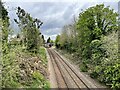
Railway south of Bedworth station
Looking north.
Image: © Andrew Abbott
Taken: 2 May 2023
0.12 miles
2
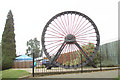
Newdigate Colliery Winding Wheel
The Newdigate Colliery Winding Wheel was donated to the council by the National Coal Board, and was in use until the mine's closure on 5th February 1982 - the last mine in the borough to close. It was erected in tribute to local miners in Bedworth's Miners Welfare Park by Nuneaton and Bedworth Borough Council and was officially unveiled on 27th March 1986.
Information taken from nearby commemorative plaque, just visibly behind the lower left of the wheel in this photo.
Image: © Niki Walton
Taken: 12 Oct 2007
0.13 miles
4
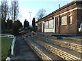
Cricket Pavilion, Miners Welfare Park, Bedworth
Closed up for the winter here, but a pleasing view of the cricket ground can be had during the cricket season, with many spectators sitting on the tiered paving.
Image: © Niki Walton
Taken: 8 Jan 2011
0.14 miles
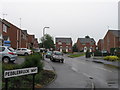
6
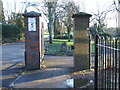
Speed Limit 5 MPH
At the vehicular entrance to the Miners Welfare Park, Bedworth.
Image: © Niki Walton
Taken: 8 Jan 2011
0.15 miles
7
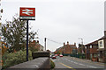
Bulkington Road, Bedworth
Taken from the railway bridge and looking out of town.
Image: © Niki Walton
Taken: 12 Oct 2007
0.15 miles
9
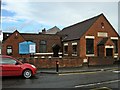
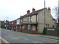
Bedworth Wesleyan Reform Church
In the former Wesleyan Reform Church School building dating from 1910.
Image: © Ian Rob
Taken: 15 Jul 2010
0.16 miles
10
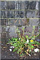
Benchmark on railway bridge, Bulkington Road
Ordnance Survey cut mark benchmark described on the Bench Mark Database at http://www.bench-marks.org.uk/bm66858
Image: © Roger Templeman
Taken: 19 May 2015
0.16 miles