
IMAGES TAKEN NEAR TO
Wootton Street, BEDWORTH, CV12 9DY
Introduction
This page details the photographs taken nearby to Wootton Street, CV12 9DY by members of the Geograph project.
The Geograph project started in 2005 with the aim of publishing, organising and preserving representative images for every square kilometre of Great Britain, Ireland and the Isle of Man.

There are currently over 7.5m images from over14,400 individuals and you can help contribute to the project by visiting https://www.geograph.org.uk
Image Map
Images are licensed for reuse under creativecommons.org/licenses/by-sa/2.0
Notes
- Clicking on the map will re-center to the selected point.
- The higher the marker number, the further away the image location is from the centre of the postcode.
Image Listing (30 Images Found)
Images are licensed for reuse under creativecommons.org/licenses/by-sa/2.0
Image
Details
Distance
1
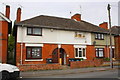
Semi-detached houses on Wootton Street
There is an OS benchmark Image on the left hand side of the left hand house
Image: © Roger Templeman
Taken: 22 May 2015
0.04 miles
2
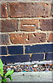
Benchmark on #136 Wootton Street
Ordnance Survey cut mark benchmark described on the Bench Mark Database at http://www.bench-marks.org.uk/bm67124
Image: © Roger Templeman
Taken: 22 May 2015
0.04 miles
3
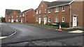
Brick Kiln Way Bedworth
Brick Kiln Way is a modern housing development built on a 'brown field' site reclaimed from industrial use.
Image: © Peter Mackenzie
Taken: 17 Jan 2017
0.11 miles
4
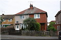
Semi-detached houses on Johnson Road
There is an OS benchmark Image on the side of the right hand house near its front corner
Image: © Roger Templeman
Taken: 22 May 2015
0.13 miles
5
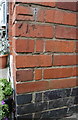
Benchmark on #33 Johnson Road
Ordnance Survey cut mark benchmark described on the Bench Mark Database at http://www.bench-marks.org.uk/bm67125
Image: © Roger Templeman
Taken: 22 May 2015
0.13 miles
6
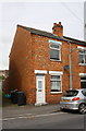
#44 Wootton Street
There is an OS benchmark Image on the left hand side of the house near its front corner
Image: © Roger Templeman
Taken: 22 May 2015
0.16 miles
7
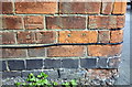
Benchmark on #44 Wootton Street
Ordnance Survey cut mark benchmark described on the Bench Mark Database at http://www.bench-marks.org.uk/bm67123
Image: © Roger Templeman
Taken: 22 May 2015
0.16 miles
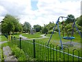
9
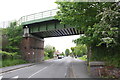
Railway bridge at east end of Chapel Street
There is an OS benchmark Image on the near corner, inside face, of the left hand bridge wall
Image: © Roger Templeman
Taken: 22 May 2015
0.19 miles
10
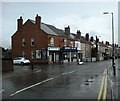
Bedworth-Bulkington Road
Shops and houses after a heavy downpour.
Image: © Ian Rob
Taken: 15 Jul 2010
0.20 miles