
IMAGES TAKEN NEAR TO
Frances Crescent, BEDWORTH, CV12 8EN
Introduction
This page details the photographs taken nearby to Frances Crescent, CV12 8EN by members of the Geograph project.
The Geograph project started in 2005 with the aim of publishing, organising and preserving representative images for every square kilometre of Great Britain, Ireland and the Isle of Man.

There are currently over 7.5m images from over14,400 individuals and you can help contribute to the project by visiting https://www.geograph.org.uk
Image Map
Images are licensed for reuse under creativecommons.org/licenses/by-sa/2.0
Notes
- Clicking on the map will re-center to the selected point.
- The higher the marker number, the further away the image location is from the centre of the postcode.
Image Listing (40 Images Found)
Images are licensed for reuse under creativecommons.org/licenses/by-sa/2.0
Image
Details
Distance
1
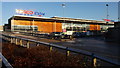
Tesco supermarket Bedworth
This large supermarket is clearly visible from many viewpoints in the centre of Bedworth.
Image: © Peter Mackenzie
Taken: 29 Dec 2016
0.11 miles
2
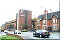
Tesco, Bedworth
Built in 1980, this Tesco store includes a car park on its upper level, accessed from George Street Ringway.
Image: © Niki Walton
Taken: 12 Oct 2007
0.12 miles
3
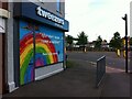
Coronavirus rainbow, Bedworth
Tweezers Beauty Bar at the corner of Mill Street and George Street Ringway, offering thanks to key workers on their shop shutters.
Image: © A J Paxton
Taken: 5 Jun 2021
0.12 miles
4
Newtown Road near Bedworth town centre
Image: © Mat Fascione
Taken: 28 Sep 2014
0.14 miles
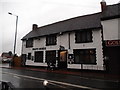
6
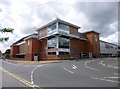
Bedworth, Tesco Extra
Supermarket and car park, seen from the corner of Leicester Street and George Street Ringway: http://www.tesco.com/store-locator/uk/?bID=6473
Image: © Mike Faherty
Taken: 8 Jun 2014
0.16 miles
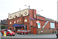
8
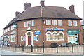
The White Swan Public House
On the corner where Mill Street meets Leicester Street in Bedworth Town Centre.
Image: © Niki Walton
Taken: 12 Oct 2007
0.16 miles
9
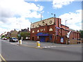
Bedworth, bingo hall
At the corner of Leicester Road and Rye Piece Ringway; formerly Palace Cinema. http://playingbingo.co.uk/land-bingo/club-finder/b/bedworth-palace-bingo-leicester-road.php
Image: © Mike Faherty
Taken: 8 Jun 2014
0.16 miles
10
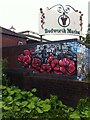
Bedworth civic mural, Mill Street
The mural is painted on a wall in Mill Street, in front of the Methodist church and the market hall, a very prominent site in the town. It was painted in 2020 by Katie Sullivan, who signs as Katie O-Art, and was commissioned and paid for by a local councillor, Bill Hancox; see this article in Bedworth Nub News https://bedworth.nub.news/n/borough-councillor-commissions-new-mural-to-bring-bedworth39s-proud-history-to-life .
Note the very strong association between coal mining, the two world wars, red poppies and remembrance in the culture of the town, visible also in the gates to the Miners' Welfare Park (see here https://www.geograph.org.uk/photo/6933518 ) and the local tradition of remembrance on Armistice Day, November 11th (see here https://www.geograph.org.uk/photo/6858984 ).
The section of mural to the right, not clearly visible here, can be seen on this geograph https://www.geograph.org.uk/photo/6933518 .
Image: © A J Paxton
Taken: 4 Aug 2021
0.16 miles