
IMAGES TAKEN NEAR TO
Marston Lane, BEDWORTH, CV12 8DH
Introduction
This page details the photographs taken nearby to Marston Lane, CV12 8DH by members of the Geograph project.
The Geograph project started in 2005 with the aim of publishing, organising and preserving representative images for every square kilometre of Great Britain, Ireland and the Isle of Man.

There are currently over 7.5m images from over14,400 individuals and you can help contribute to the project by visiting https://www.geograph.org.uk
Image Map
Images are licensed for reuse under creativecommons.org/licenses/by-sa/2.0
Notes
- Clicking on the map will re-center to the selected point.
- The higher the marker number, the further away the image location is from the centre of the postcode.
Image Listing (26 Images Found)
Images are licensed for reuse under creativecommons.org/licenses/by-sa/2.0
Image
Details
Distance
1
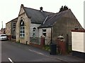
Methodist church & Sunday school, Orchard Street, Collycroft, Bedworth
The nearer building is the school, with the chapel behind, next to the white van. Orchard Street was originally Back Lane, at the back of the main road north out of Bedworth, and this area was built up by the mid to late 19th century. An ‘Ebenezer’ Primitive Methodist Chapel was built in Back Lane in 1851. It was rebuilt in 1878 and a Sunday school added in 1907. They are still in use as a Methodist church.
Image: © A J Paxton
Taken: 5 Jun 2021
0.04 miles
2
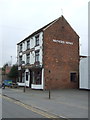
The Miners Arms, Collycroft, Bedworth
On Marston Lane.
Image: © JThomas
Taken: 11 Mar 2017
0.04 miles
3
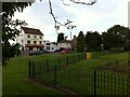
Miners Arms pub and Bailey Park play area, corner of Leicester Road and Marston Lane, Collycroft, Bedworth
This is a much re-landscaped industrial area. The OS Six Inch map, 1888-1913 series, shows the Hawkesbury & Bedworth Brick & Tile Works on the site now occupied by the park, with a mineral line running along one side and across Leicester Road to the Bedworth Charity Colliery. https://maps.nls.uk/geo/explore/side-by-side/#zoom=17&lat=52.48615&lon=-1.47313&layers=6&right=OSAPI
Image: © A J Paxton
Taken: 5 Jun 2021
0.04 miles
4
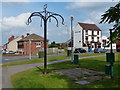
Miners Arms in Bedworth
Public house along Marston Lane.
Image: © Mat Fascione
Taken: 28 Sep 2014
0.05 miles
5
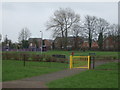
Children's playground, Collycroft, Bedworth
Image: © JThomas
Taken: 11 Mar 2017
0.06 miles
7
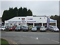
Garage on Nuneaton Road, Collycroft, Bedworth
Image: © JThomas
Taken: 11 Mar 2017
0.08 miles
8
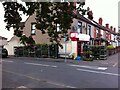
Off Licence, corner of Knightsbridge Avenue & Marston Lane
Booze Zone of Marston Lane, Bedworth, is doing a busy sideline in potted plants, which are being watered on a warm June evening.
Image: © A J Paxton
Taken: 5 Jun 2021
0.08 miles
9
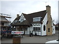
The Old Royal Oak public house, Collycroft, Bedworth
On Nuneaton Road (B4113).
Image: © JThomas
Taken: 11 Mar 2017
0.09 miles
10
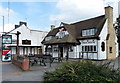
Old Royal Oak in Bedworth
A public house along Nuneaton Road.
Image: © Mat Fascione
Taken: 28 Sep 2014
0.09 miles