
IMAGES TAKEN NEAR TO
Heart Of England Way, CV11 8AB
Introduction
This page details the photographs taken nearby to Heart Of England Way, CV11 8AB by members of the Geograph project.
The Geograph project started in 2005 with the aim of publishing, organising and preserving representative images for every square kilometre of Great Britain, Ireland and the Isle of Man.

There are currently over 7.5m images from over14,400 individuals and you can help contribute to the project by visiting https://www.geograph.org.uk
Image Map
Images are licensed for reuse under creativecommons.org/licenses/by-sa/2.0
Notes
- Clicking on the map will re-center to the selected point.
- The higher the marker number, the further away the image location is from the centre of the postcode.
Image Listing (11 Images Found)
Images are licensed for reuse under creativecommons.org/licenses/by-sa/2.0
Image
Details
Distance
1

Busy roundabout
The heavy traffic is effectively managed by this large roundabout on the A4254.
Image: © Peter Mackenzie
Taken: 21 Feb 2017
0.06 miles

3
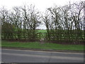
Footpath off Eastboro Way (A4254)
Looking east.
Image: © JThomas
Taken: 4 Mar 2017
0.12 miles
4

Attleborough Fields Industrial Estate
Image: © John Winterbottom
Taken: 6 Jan 2006
0.13 miles
5
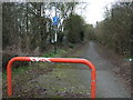
Cycle path off Eastboro Way (A4254)
Looking west.
Image: © JThomas
Taken: 4 Mar 2017
0.14 miles
6
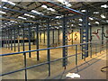
Interior of former Adams warehouse, Townsend Drive
The easterly of the two warehouse sheds, during the period that the warehouse offices were occupied by property guardians, between the collapse of the Adams children's clothing building in 2010 and the acquisition of the site by the bathroom supplier Soak.com in 2013. The AdamsKids logo featured the top of an apple; note here the curious snakes and ladders mural, suggesting childhood play but also the old story of the Fall. The mezzanine floor in the foreground was stacked with paperwork and samples left behind by the failed business.
Image: © A J Paxton
Taken: 31 May 2013
0.18 miles
7
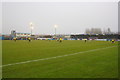
Nuneaton Town football ground
Visitors Bristol Rovers in yellow shirts take on Nuneaton Town in a Conference Premier match on a misty 4 January 2015. Rovers won 2-0.
Image: © Roger Templeman
Taken: 4 Jan 2015
0.19 miles
8
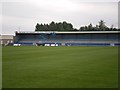
Dead End, Nuneaton Borough A.F.C.
Nuneaton Boroughs new ground at Liberty Way. The football and rugby clubs now use the same ground.
Image: © Gerry Swingler
Taken: 15 Jul 2007
0.21 miles
9
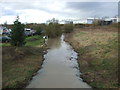
The River Anker
Looking north west from the bridge on Eastboro Way (A4254).
Image: © JThomas
Taken: 4 Mar 2017
0.22 miles
10
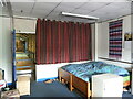
Office in former Adams warehouse, Townsend Drive
A property guardian bed sitting room in a former warehouse office overlooking the warehouse shed, 2013. Most property guardians lived in the offices of the adjoining administration buildings, but a few lived in the offices of the warehouse itself. There was no heating provided. The period of property guardian occupancy occurred between the collapses of the Adams business in 2010 and the acquisition of the warehouse by Soak.com in 2013.
Image: © A J Paxton
Taken: 30 May 2013
0.23 miles