IMAGES TAKEN NEAR TO
Ragley Way, NUNEATON, CV11 6SU
Introduction
This page details the photographs taken nearby to Ragley Way, CV11 6SU by members of the Geograph project.
The Geograph project started in 2005 with the aim of publishing, organising and preserving representative images for every square kilometre of Great Britain, Ireland and the Isle of Man.

There are currently over 7.5m images from over14,400 individuals and you can help contribute to the project by visiting https://www.geograph.org.uk
Image Map (Loading...)


Getting Data...Please wait
Leaflet Map data © OpenStreetMap
Images are licensed for reuse under creativecommons.org/licenses/by-sa/2.0
Notes
- Clicking on the map will re-center to the selected point.
- The higher the marker number, the further away the image location is from the centre of the postcode.
Image Listing (24 Images Found)
Images are licensed for reuse under creativecommons.org/licenses/by-sa/2.0
Image
Details
Distance
1
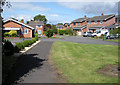
Attleborough Housing Estate
Chartwell Close
Image: © Beryl Allcoat
Taken: 8 Jul 2008
0.06 miles
2
'The other side of the track'
Steps from Bridge 40 on the West Coast Main Line to the Crowhill Housing estate
Image: © Beryl Allcoat
Taken: 3 Jul 2008
0.13 miles
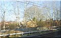
4
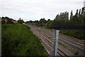
Rail Views WCML
'Down' from London, Nuneaton Approach
Image: © Beryl Allcoat
Taken: 8 Jul 2008
0.16 miles
6
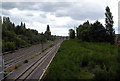
Railway Views, WCML
'Down' Approach to Nuneaton, at Attleborough
Image: © Beryl Allcoat
Taken: 8 Jul 2008
0.16 miles
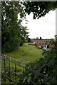
7
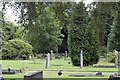
Attleborough Cemetery
South East Corner
Image: © Beryl Allcoat
Taken: 3 Jul 2008
0.17 miles
8
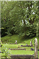
Attleborough Cemetery
South East Corner
Image: © Beryl Allcoat
Taken: 3 Jul 2008
0.17 miles
9
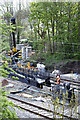
WCML New Signals
West Coast Main Line, upgrade to the signalling infrastructure.
Image: © Beryl Allcoat
Taken: 3 May 2008
0.17 miles
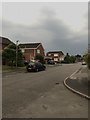
10
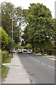
Attleborough, Lutterworth Road
B4114 Nuneaton to Lutterworth
Image: © Beryl Allcoat
Taken: 3 Jul 2008
0.19 miles