IMAGES TAKEN NEAR TO
Townsend Drive, NUNEATON, CV11 6RU
Introduction
This page details the photographs taken nearby to Townsend Drive, CV11 6RU by members of the Geograph project.
The Geograph project started in 2005 with the aim of publishing, organising and preserving representative images for every square kilometre of Great Britain, Ireland and the Isle of Man.

There are currently over 7.5m images from over14,400 individuals and you can help contribute to the project by visiting https://www.geograph.org.uk
Image Map
Images are licensed for reuse under creativecommons.org/licenses/by-sa/2.0
Notes
- Clicking on the map will re-center to the selected point.
- The higher the marker number, the further away the image location is from the centre of the postcode.
Image Listing (19 Images Found)
Images are licensed for reuse under creativecommons.org/licenses/by-sa/2.0
Image
Details
Distance
1
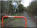
Cycle path off Eastboro Way (A4254)
Looking west.
Image: © JThomas
Taken: 4 Mar 2017
0.08 miles
2

Attleborough Fields Industrial Estate
Image: © John Winterbottom
Taken: 6 Jan 2006
0.10 miles
3
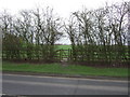
Footpath off Eastboro Way (A4254)
Looking east.
Image: © JThomas
Taken: 4 Mar 2017
0.10 miles
4
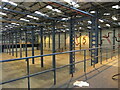
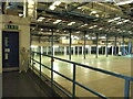
Interior of former Adams warehouse, Townsend Drive
The easterly of the two warehouse sheds, during the period that the warehouse offices were occupied by property guardians, between the collapse of the Adams children's clothing building in 2010 and the acquisition of the site by the bathroom supplier Soak.com in 2013. The AdamsKids logo featured the top of an apple; note here the curious snakes and ladders mural, suggesting childhood play but also the old story of the Fall. The mezzanine floor in the foreground was stacked with paperwork and samples left behind by the failed business.
Image: © A J Paxton
Taken: 31 May 2013
0.10 miles
5
Interior of former Adams warehouse, Townsend Drive
The view from outside a property guardian's front door, 2013. This is the more westerly of the two warehouse sheds on the site.
Image: © A J Paxton
Taken: 30 May 2013
0.11 miles

7
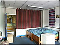
Office in former Adams warehouse, Townsend Drive
A property guardian bed sitting room in a former warehouse office overlooking the warehouse shed, 2013. Most property guardians lived in the offices of the adjoining administration buildings, but a few lived in the offices of the warehouse itself. There was no heating provided. The period of property guardian occupancy occurred between the collapses of the Adams business in 2010 and the acquisition of the warehouse by Soak.com in 2013.
Image: © A J Paxton
Taken: 30 May 2013
0.11 miles
8
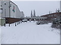
Former Adams warehouse and offices, Townsend Drive
A warehouse with offices on the Attleborough Fields industrial estate. The Adams children's clothing business was founded in by Amy Adams in Birmingham in 1933. By the early 2000s the business had passed through several changes of ownership and had over two hundred stores and several international franchises. It went into administration in 2006, 2008 and finally in 2010, when its remaining stores closed. https://en.wikipedia.org/wiki/Adams_Kids The abandoned offices were lived in by property guardians until 2013. The bathroom goods retailer Soak.com then used the warehouse until it too ceased trading in 2020. https://www.coventrytelegraph.net/news/coventry-news/nuneaton-based-soakcom-collapses-goes-18327735
Image: © A J Paxton
Taken: 20 Jan 2013
0.13 miles
9

Busy roundabout
The heavy traffic is effectively managed by this large roundabout on the A4254.
Image: © Peter Mackenzie
Taken: 21 Feb 2017
0.17 miles