IMAGES TAKEN NEAR TO
Hinckley Road, NUNEATON, CV11 6LF
Introduction
This page details the photographs taken nearby to Hinckley Road, CV11 6LF by members of the Geograph project.
The Geograph project started in 2005 with the aim of publishing, organising and preserving representative images for every square kilometre of Great Britain, Ireland and the Isle of Man.

There are currently over 7.5m images from over14,400 individuals and you can help contribute to the project by visiting https://www.geograph.org.uk
Image Map (Loading...)


Getting Data...Please wait
Leaflet Map data © OpenStreetMap
Images are licensed for reuse under creativecommons.org/licenses/by-sa/2.0
Notes
- Clicking on the map will re-center to the selected point.
- The higher the marker number, the further away the image location is from the centre of the postcode.
Image Listing (18 Images Found)
Images are licensed for reuse under creativecommons.org/licenses/by-sa/2.0
Image
Details
Distance
1
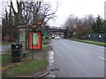
Bus stop and shelter on Hinckley Road (A47)
Image: © JThomas
Taken: 25 Feb 2017
0.04 miles
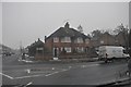
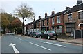
2
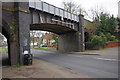
Hinckley Road, Nuneaton
The railway here is now disused, but was once part of the Midland Railway's Leicester - Birmingham line. It originally opened in 1864; regular passenger services ceased in 1968 when trains were diverted via the Trent Valley station. The line was closed completely in 1992.
Image: © Stephen McKay
Taken: 8 Mar 2014
0.06 miles
3
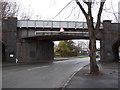
Disused railway bridge over Hinckley Road (A47)
Image: © JThomas
Taken: 25 Feb 2017
0.06 miles
4
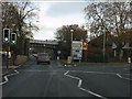
A47 at the former Nuneaton avoiding line bridge
Image: © Peter Whatley
Taken: 12 Nov 2011
0.07 miles
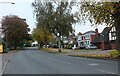
5
Nuneaton : Leicester Road
Leicester Road with St Nicholas Road straight on.
Image: © Lewis Clarke
Taken: 6 Feb 2012
0.09 miles
7
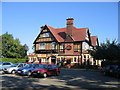
The John Barras
A large pseudo-half timbered road house style pub in Higham Lane.
Image: © David Stowell
Taken: 21 Sep 2006
0.16 miles
9
Old Hinckley Road, Nuneaton
Part of the complex town centre one way system.
Image: © David Howard
Taken: 18 Oct 2020
0.19 miles
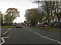
10
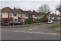
Kingsbridge Road, Nuneaton
Detached and semi-detached houses seen from Shanklin Drive. These houses probably date from the late 1930s.
Image: © Stephen McKay
Taken: 8 Mar 2014
0.20 miles