IMAGES TAKEN NEAR TO
Loweswater Close, NUNEATON, CV11 6EU
Introduction
This page details the photographs taken nearby to Loweswater Close, CV11 6EU by members of the Geograph project.
The Geograph project started in 2005 with the aim of publishing, organising and preserving representative images for every square kilometre of Great Britain, Ireland and the Isle of Man.

There are currently over 7.5m images from over14,400 individuals and you can help contribute to the project by visiting https://www.geograph.org.uk
Image Map
Images are licensed for reuse under creativecommons.org/licenses/by-sa/2.0
Notes
- Clicking on the map will re-center to the selected point.
- The higher the marker number, the further away the image location is from the centre of the postcode.
Image Listing (18 Images Found)
Images are licensed for reuse under creativecommons.org/licenses/by-sa/2.0
Image
Details
Distance
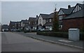
6
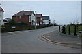
Greendale Road, Nuneaton
At the corner of Hinckley Road
Image: © David Howard
Taken: 18 Oct 2020
0.20 miles
7
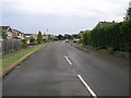
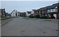
Langdale Drive
Langdale Drive is typical of the kind of housing in this part of Nuneaton.
Image: © Michael Patterson
Taken: 12 Jun 2006
0.20 miles
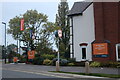
9
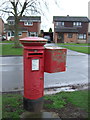
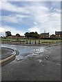
Elizabeth II postbox on St. Nicolas Park Drive
Postbox No. CV11 200.
Image: © JThomas
Taken: 25 Feb 2017
0.20 miles
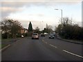
10
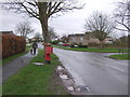
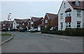
St. Nicolas Park Drive
Showing position of Postbox No. CV11 200.
Image: © JThomas
Taken: 25 Feb 2017
0.20 miles