IMAGES TAKEN NEAR TO
Whitacre Road, NUNEATON, CV11 6BN
Introduction
This page details the photographs taken nearby to Whitacre Road, CV11 6BN by members of the Geograph project.
The Geograph project started in 2005 with the aim of publishing, organising and preserving representative images for every square kilometre of Great Britain, Ireland and the Isle of Man.

There are currently over 7.5m images from over14,400 individuals and you can help contribute to the project by visiting https://www.geograph.org.uk
Image Map
Images are licensed for reuse under creativecommons.org/licenses/by-sa/2.0
Notes
- Clicking on the map will re-center to the selected point.
- The higher the marker number, the further away the image location is from the centre of the postcode.
Image Listing (9 Images Found)
Images are licensed for reuse under creativecommons.org/licenses/by-sa/2.0
Image
Details
Distance
1
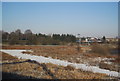
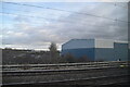
Wasteland between the West Coast Main Line and the Leicester line
Image: © N Chadwick
Taken: 19 Dec 2010
0.17 miles
3
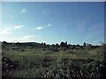
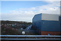
Between the lines
Uncultivated land between the Birmingham to Leicester line and the West Coast main line as seen from the Cornish Riviera Statesman excursion train as it approached Nuneaton South Junction
Image: © Tim Glover
Taken: 25 Sep 2020
0.21 miles
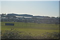
4
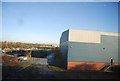
Allotments by Attleborough Industrial Estate
Image: © N Chadwick
Taken: 19 Dec 2010
0.21 miles
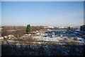
5

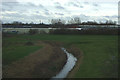
View from a Rugby-Crewe train - allotments through the blossom
Image: © Nigel Thompson
Taken: 24 May 2016
0.23 miles