
IMAGES TAKEN NEAR TO
Quincy Close, NUNEATON, CV11 6AY
Introduction
This page details the photographs taken nearby to Quincy Close, CV11 6AY by members of the Geograph project.
The Geograph project started in 2005 with the aim of publishing, organising and preserving representative images for every square kilometre of Great Britain, Ireland and the Isle of Man.

There are currently over 7.5m images from over14,400 individuals and you can help contribute to the project by visiting https://www.geograph.org.uk
Image Map
Images are licensed for reuse under creativecommons.org/licenses/by-sa/2.0
Notes
- Clicking on the map will re-center to the selected point.
- The higher the marker number, the further away the image location is from the centre of the postcode.
Image Listing (44 Images Found)
Images are licensed for reuse under creativecommons.org/licenses/by-sa/2.0
Image
Details
Distance
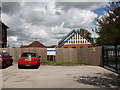
2
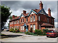
Bramcote Hospital
The photo shows the main and I think the earliest part of this small hospital. When this photo was taken, the buildings appeared to be still partially in use.
Image: © John Brightley
Taken: 5 Aug 2012
0.04 miles
3
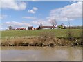
Housing on the site of Bramcote Hospital, viewed from the Ashby-de-la-Zouch Canal
For more information on the hospital, which closed in 2011, see Image] and the shared description attached.
Image: © A J Paxton
Taken: 2 Apr 2023
0.07 miles
4
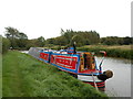
Working Narrow Boat Hadar moored near Mill Bridge Burton Hastings
Working Narrow Boat Hadar moored near Mill Bridge No.8, Burton Hastings, Ashby Canal, August 2012.
Image: © Keith Lodge
Taken: 22 Aug 2012
0.11 miles
5
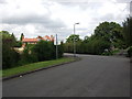
Entrance driveway to Bramcote Hospital
Image: © John Brightley
Taken: 5 Aug 2012
0.11 miles
6
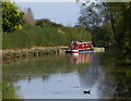
Narrowboat moored along the Ashby Canal
This is the stretch of canal between bridges 6 and 8.
The navigable part of the Ashby Canal heads in a northerly direction for 22 miles, from its start at Marston Junction, to its terminus north of Snarestone. There are no locks along its entire length.
Image: © Mat Fascione
Taken: 28 Sep 2014
0.12 miles
7
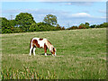
Canalside grazing near Bramcote in Warwickshire
This is by the Ashby Canal north of Bramcote Road Bridge, No 6.
Image: © Roger Kidd
Taken: 22 Sep 2016
0.12 miles
8
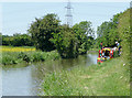
The Ashby Canal near Bramcote, Warwickshire
Looking towards Nuneaton.
At present the canal provides 22 miles of lock free cruising. Originally it went as far north as Conkers (near Moira), but never reached Ashby-de-la-Zouch. Coal was carried on a regular commercial basis until the 1960s. At present the canal stops at Snarestone, though the eight mile stretch to Moira is being (or has been) restored. The canal was opened in 1804.
Image: © Roger D Kidd
Taken: 16 Jun 2010
0.12 miles
9
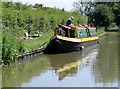
The Ashby Canal near Bramcote, Warwickshire
Narrowboat "Rosie" is receiving some maintenance while the good weather lasts.
At present the canal provides 22 miles of lock free cruising. Originally it went as far north as Conkers (near Moira), but never reached Ashby-de-la-Zouch. Coal was carried on a regular commercial basis until the 1960s. At present the canal stops at Snarestone, though the eight mile stretch to Moira is being (or has been) restored. The canal was opened in 1804.
Image: © Roger D Kidd
Taken: 16 Jun 2010
0.12 miles
10

Entrance drive, Bramcote Hospital
The building called 'The Lodge' is on the right.
Image: © John Brightley
Taken: 5 Aug 2012
0.12 miles