
IMAGES TAKEN NEAR TO
Edward Street, NUNEATON, CV11 5RA
Introduction
This page details the photographs taken nearby to Edward Street, CV11 5RA by members of the Geograph project.
The Geograph project started in 2005 with the aim of publishing, organising and preserving representative images for every square kilometre of Great Britain, Ireland and the Isle of Man.

There are currently over 7.5m images from over14,400 individuals and you can help contribute to the project by visiting https://www.geograph.org.uk
Image Map
Images are licensed for reuse under creativecommons.org/licenses/by-sa/2.0
Notes
- Clicking on the map will re-center to the selected point.
- The higher the marker number, the further away the image location is from the centre of the postcode.
Image Listing (71 Images Found)
Images are licensed for reuse under creativecommons.org/licenses/by-sa/2.0
Image
Details
Distance
1
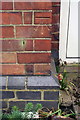
Benchmark on #159 Edward Street
Ordnance Survey cut mark described on the Bench Mark Database at http://www.bench-marks.org.uk/bm74892
Image: © Roger Templeman
Taken: 5 Apr 2016
0.01 miles
2
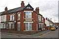
'Edward House' at Edward Street / Frank Street junction
There is an OS benchmark Image on the right hand face of the house, left of a white door
Image: © Roger Templeman
Taken: 5 Apr 2016
0.01 miles
3
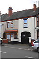
#193 Edward Street
Ordnance Survey records indicate that in 1958 a benchmark levelled at 84.582m above Newlyn Datum was verified on the side wall of the house at its junction with the left hand side of the gate arch
Image: © Roger Templeman
Taken: 5 Apr 2016
0.05 miles
4
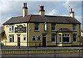
The Rose Inn in Nuneaton
A Marston's public house along the A444 Coton Road.
Image: © Mat Fascione
Taken: 28 Sep 2014
0.11 miles
5
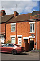
Houses on Princes Street
There is an Ordnance Survey benchmark Image below the #51 number sign left of the alleyway entrance (obscured by car boot)
Image: © Roger Templeman
Taken: 5 Apr 2016
0.12 miles
6
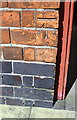
Benchmark on #51 Princes Street
Ordnance Survey cut mark benchmark described on the Bench Mark Database at http://www.bench-marks.org.uk/bm74891
Image: © Roger Templeman
Taken: 5 Apr 2016
0.12 miles
7
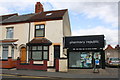
Houses and Pharmacy Republic, Edward Street
House #102 carries name 'Dempster' on the stone over its door: the Pharmacy is #104. Ordnance Survey documents indicate that in 1958 a benchmark levelled at 88.785m above Newlyn Datum was verified on the road end of party wall between the two properties
Image: © Roger Templeman
Taken: 5 Apr 2016
0.13 miles
9
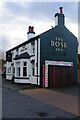
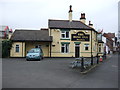
The Rose Inn, Nuneaton
This unassuming-looking Coton Road pub has an unlikely claim to fame as the venue for the Campaign for Real Ale's first AGM in 1972. It was refurbished in 2021.
Image: © Stephen McKay
Taken: 9 Nov 2022
0.13 miles
10
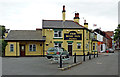
The Rose Inn in Nuneaton
The Rose Inn is a Marston's public house in Coton Road.
Image: © Roger D Kidd
Taken: 19 Aug 2013
0.13 miles