
IMAGES TAKEN NEAR TO
Victoria Street, NUNEATON, CV11 5QE
Introduction
This page details the photographs taken nearby to Victoria Street, CV11 5QE by members of the Geograph project.
The Geograph project started in 2005 with the aim of publishing, organising and preserving representative images for every square kilometre of Great Britain, Ireland and the Isle of Man.

There are currently over 7.5m images from over14,400 individuals and you can help contribute to the project by visiting https://www.geograph.org.uk
Image Map
Images are licensed for reuse under creativecommons.org/licenses/by-sa/2.0
Notes
- Clicking on the map will re-center to the selected point.
- The higher the marker number, the further away the image location is from the centre of the postcode.
Image Listing (122 Images Found)
Images are licensed for reuse under creativecommons.org/licenses/by-sa/2.0
Image
Details
Distance
1
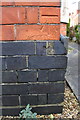
Benchmark on Harcourt Villa
Ordnance Survey cut mark benchmark described on the Bench Mark Database at http://www.bench-marks.org.uk/bm74887
Image: © Roger Templeman
Taken: 5 Apr 2016
0.08 miles
2
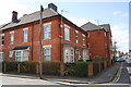
Houses at bend in Princes Street
There is an OS benchmark Image on the near corner, left hand face (behind hedge) of this former pub
Image: © Roger Templeman
Taken: 5 Apr 2016
0.08 miles
3
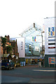
New Rope Walk
Rope Walk Shopping Centre, Nuneaton
Image: © Beryl Allcoat
Taken: 27 Jan 2008
0.08 miles
4
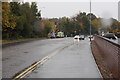
Roanne Ringway
Nuneaton's inner ring road is seen here in rain.
Image: © Bill Boaden
Taken: 14 Oct 2018
0.08 miles
5
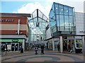
Nuneaton-Ropewalk Shopping Centre
Queens Road Entrance.
Image: © Ian Rob
Taken: 4 Mar 2015
0.08 miles
6
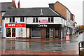
Lord Hop
CAMRA's Warwickshire Pub of the Year 2017, situated on the corner of Queens Road and Dugdale Street. It is viewed in rain.
Image: © Bill Boaden
Taken: 14 Oct 2018
0.08 miles
7
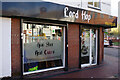
Lord Hop, Nuneaton
This micropub at the western end of Nuneaton town centre is rather larger than most and has upstairs seating. The Lord Hop name derives from the nickname given by Nuneaton people to a former local squire whose ghost haunted the (long demolished) Dun Cow pub in the town. It is said he would travel around in a coach drawn by four headless horses until his spirit was confined to a bottle that was thrown into a clay pit. The bottle was later found and inadvertently uncorked allowing Lord Hop to return to haunting the Dun Cow. This story has remarkable similarities to that of another Warwickshire ghost, One-handed Boughton - see Image
Image: © Stephen McKay
Taken: 9 Nov 2022
0.09 miles
8
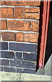
Benchmark on #51 Princes Street
Ordnance Survey cut mark benchmark described on the Bench Mark Database at http://www.bench-marks.org.uk/bm74891
Image: © Roger Templeman
Taken: 5 Apr 2016
0.09 miles
9
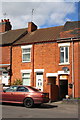
Houses on Princes Street
There is an Ordnance Survey benchmark Image below the #51 number sign left of the alleyway entrance (obscured by car boot)
Image: © Roger Templeman
Taken: 5 Apr 2016
0.09 miles
10
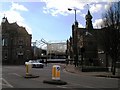
The Ropewalk shopping centre in course of construction, Nuneaton
A photo taken halfway through the construction process of the new building which can be seen in the background.
Coventry Street can be seen in the foreground - it becomes Coton Road to the left.
The truncated remains of Chapel Street can be seen in the centre of the photo - the Ropewalk was constructed over much of the street's former length.
Image: © John Brightley
Taken: 19 Feb 2005
0.09 miles