
IMAGES TAKEN NEAR TO
Fifield Close, NUNEATON, CV11 4TS
Introduction
This page details the photographs taken nearby to Fifield Close, CV11 4TS by members of the Geograph project.
The Geograph project started in 2005 with the aim of publishing, organising and preserving representative images for every square kilometre of Great Britain, Ireland and the Isle of Man.

There are currently over 7.5m images from over14,400 individuals and you can help contribute to the project by visiting https://www.geograph.org.uk
Image Map
Images are licensed for reuse under creativecommons.org/licenses/by-sa/2.0
Notes
- Clicking on the map will re-center to the selected point.
- The higher the marker number, the further away the image location is from the centre of the postcode.
Image Listing (30 Images Found)
Images are licensed for reuse under creativecommons.org/licenses/by-sa/2.0
Image
Details
Distance
2
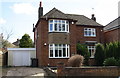
#150 Attleborough Road
There is an OS benchmark Image on the left hand side of the house at its front corner
Image: © Roger Templeman
Taken: 9 Apr 2016
0.05 miles
3
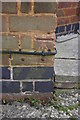
Benchmark on #150 Attleborough Road
Ordnance Survey cut mark benchmark described on the Bench Mark Database at http://www.bench-marks.org.uk/bm74904
Image: © Roger Templeman
Taken: 9 Apr 2016
0.05 miles
5
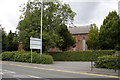
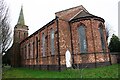
Attleborough Holy Trinity Church
Built as a 'Chapel of Ease' of Nuneaton St Nicholas, for the Ribbon and Silk workers
Image: © Beryl Allcoat
Taken: 11 Jul 2008
0.06 miles
6
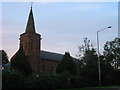
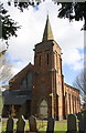
Holy Trinity Church
Holy Trinity was consecrated in 1842 having been built by William Arthur Watson. It was erected on a site gifted by the Right Honourable Dudley, Earl of Harrowby.
At the time when the church was built, Attleborough, with a population of 1,094, was essentially a working class village with over 60% of its workforce engaged in the ribbon weaving industry. At the time of the church's 150th anniversary in 1992 Attleborough had grown to a population of over 15,000 and had more or less merged with Nuneaton.
Image: © Ian Dunckley
Taken: 3 Aug 2005
0.07 miles
7
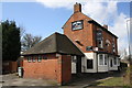
The Bull & Spice, Avenue Road
There is an OS benchmark Image on the near angle, right hand face, of the main pub building
Image: © Roger Templeman
Taken: 9 Apr 2016
0.07 miles
8
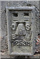
Benchmark on 'The Bull & Spice'
Ordnance Survey flush bracket (identifier G2538) benchmark described on the Bench Mark Database at http://www.bench-marks.org.uk/bm14471
Image: © Roger Templeman
Taken: 9 Apr 2016
0.07 miles
9
Attleborough Village
'Old' Church Walk
Image: © Beryl Allcoat
Taken: 11 Jul 2008
0.07 miles
10
'Old' Church Walk
Now the Church carpark
Image: © Beryl Allcoat
Taken: 11 Jul 2008
0.08 miles