
IMAGES TAKEN NEAR TO
Purcell Avenue, NUNEATON, CV11 4SN
Introduction
This page details the photographs taken nearby to Purcell Avenue, CV11 4SN by members of the Geograph project.
The Geograph project started in 2005 with the aim of publishing, organising and preserving representative images for every square kilometre of Great Britain, Ireland and the Isle of Man.

There are currently over 7.5m images from over14,400 individuals and you can help contribute to the project by visiting https://www.geograph.org.uk
Image Map
Images are licensed for reuse under creativecommons.org/licenses/by-sa/2.0
Notes
- Clicking on the map will re-center to the selected point.
- The higher the marker number, the further away the image location is from the centre of the postcode.
Image Listing (44 Images Found)
Images are licensed for reuse under creativecommons.org/licenses/by-sa/2.0
Image
Details
Distance

2
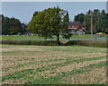
Field and hedge along the Ashby Canal
In the distance is a football match on the playing field of Chetwynd Junior School.
Image: © Mat Fascione
Taken: 28 Sep 2014
0.16 miles
3
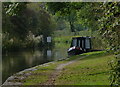
Ashby Canal near Bulking Road Bridge
The navigable part of the Ashby Canal heads in a northerly direction for 22 miles, from its start at Marston Junction, to its terminus north of Snarestone. There are no locks along its entire length.
Image: © Mat Fascione
Taken: 28 Sep 2014
0.16 miles
4
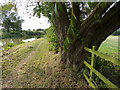
Tree along the Ashby Canal towpath
The navigable part of the Ashby Canal heads in a northerly direction for 22 miles, from its start at Marston Junction, to its terminus north of Snarestone. There are no locks along its entire length.
Image: © Mat Fascione
Taken: 28 Sep 2014
0.16 miles
5
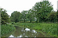
Ashby Canal south of Whitestone in Nuneaton, Warwickshire
Looking west towards Marston Junction and Bedworth.
Image: © Roger Kidd
Taken: 18 Jun 2010
0.17 miles
6
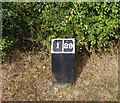
Mile marker along the Ashby Canal
One mile from the start of the canal at Marston Junction, twenty-nine miles to Moira, although nowadays the canal terminates 21 miles away near Snarestone.
There are no locks along its entire length.
Image: © Mat Fascione
Taken: 28 Sep 2014
0.17 miles

8
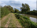
Towpath along the Ashby Canal
The navigable part of the Ashby Canal heads in a northerly direction for 22 miles, from its start at Marston Junction, to its terminus north of Snarestone. There are no locks along its entire length.
Image: © Mat Fascione
Taken: 28 Sep 2014
0.18 miles
10
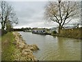
Marston, moorings
Narrowboats "Cassiopeia" and "Princess Rhianne" moored on Ashby Canal.
Image: © Mike Faherty
Taken: 21 Feb 2016
0.18 miles