IMAGES TAKEN NEAR TO
St. Lawrence Road, NUNEATON, CV10 9PW
Introduction
This page details the photographs taken nearby to St. Lawrence Road, CV10 9PW by members of the Geograph project.
The Geograph project started in 2005 with the aim of publishing, organising and preserving representative images for every square kilometre of Great Britain, Ireland and the Isle of Man.

There are currently over 7.5m images from over14,400 individuals and you can help contribute to the project by visiting https://www.geograph.org.uk
Image Map
Images are licensed for reuse under creativecommons.org/licenses/by-sa/2.0
Notes
- Clicking on the map will re-center to the selected point.
- The higher the marker number, the further away the image location is from the centre of the postcode.
Image Listing (28 Images Found)
Images are licensed for reuse under creativecommons.org/licenses/by-sa/2.0
Image
Details
Distance
1
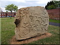
Carved stone sculpture, Birmingham Road, Ansley
Woodkirk sandstone sculpture called "Tom", by Graeme Mitcheson, http://www.chisel-it.co.uk.
Installed on Ansley village green in December 2009 as part of the North Arden Heritage Trail,http://www.northwarks.gov.uk/ardentrail, a Heritage Lottery funded project.
Scenes represent Ansley's heritage and natural environment-from mines to railways and ribbons and from Great Crested Newts to conkers and brooks. The central image, showing a man torn between the dragon and the lamb, represents the struggle of good against evil and is taken from the Norman carving in St Laurence’s Church.
Other sculptures created for the Trail can be found in Fillongley, Nether Whitacre and Astley -see Image]
Image: © John Brightley
Taken: 18 May 2010
0.07 miles
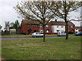
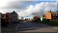
3
Ludford Close
Local authority housing in Ansley village.
Image: © Peter Mackenzie
Taken: 30 Oct 2017
0.07 miles
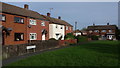
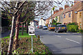
5
Birmingham Road, Ansley
B4112 looking north-west by Malthouse Farm.
Image: © Jonathan Billinger
Taken: 7 Feb 2017
0.09 miles
6
Birmingham Road, Ansley
The 'Slow down think!' sign is labelled 'Warwickshire Police' and 'Warwickshire County Council'. The speed limit here is 30mph.
Image: © Stephen McKay
Taken: 2 Nov 2022
0.09 miles
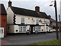
7
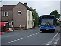
Bus and chip shop, Ansley
The bus driver has just set someone down at the bus stop, but has also switched off his destination indicator, so must be at the end of the route, though I don't know which one!
Image: © John Brightley
Taken: 18 May 2010
0.10 miles
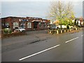
8
Ansley Fish Bar, Birmingham Road, Ansley
Image: © John Brightley
Taken: 18 May 2010
0.10 miles
9
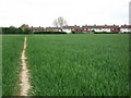
Footpath from Wood Farm approaching Ansley
Image: © John Brightley
Taken: 18 May 2010
0.11 miles
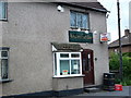
10
Ansley Social Club
Near the Lord Nelson public house and Ansley Post Office.
Image: © Richard Harrison
Taken: 30 Oct 2005
0.11 miles