
IMAGES TAKEN NEAR TO
Waltham Crescent, NUNEATON, CV10 9JQ
Introduction
This page details the photographs taken nearby to Waltham Crescent, CV10 9JQ by members of the Geograph project.
The Geograph project started in 2005 with the aim of publishing, organising and preserving representative images for every square kilometre of Great Britain, Ireland and the Isle of Man.

There are currently over 7.5m images from over14,400 individuals and you can help contribute to the project by visiting https://www.geograph.org.uk
Image Map
Images are licensed for reuse under creativecommons.org/licenses/by-sa/2.0
Notes
- Clicking on the map will re-center to the selected point.
- The higher the marker number, the further away the image location is from the centre of the postcode.
Image Listing (18 Images Found)
Images are licensed for reuse under creativecommons.org/licenses/by-sa/2.0
Image
Details
Distance
1
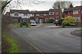
Frensham Drive, Whittleford
Frensham Drive takes a right angle turn here.
Image: © Stephen McKay
Taken: 6 Dec 2017
0.10 miles
2
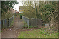
Bridge over the Black Track
The footbridge passes over the Black Track, a former colliery branch line. The bridge connects Selby Way with Chaucer Drive.
Image: © Stephen McKay
Taken: 6 Dec 2017
0.18 miles
3
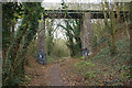
The Black Track
The Black Track was a railway built in 1876 to serve Stockingford and Ansley Hall collieries. It was abandoned in 1964 and is now a footpath. Note that murals - celebrating the local coal industry - have been painted at the foot of the bridge piers.
Image: © Stephen McKay
Taken: 6 Dec 2017
0.19 miles
4
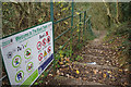
Welcome to the Black Track
Nuneaton and Bedworth Council has posted a long list of 'do's and don'ts' at this access point to the Black Track by the end of Selby Way. The Black Track is, in fact, a disused railway now converted to a footpath. The railway provided access to Stockingford and Ansley Hall collieries; this stretch was abandoned in November 1964 when the former closed. Presumably the Black Track name is a reference to the colour of coal - it seems likely that spilt coal dust would at one time have given the line a black appearance.
Image: © Stephen McKay
Taken: 6 Dec 2017
0.19 miles
5
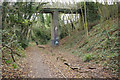
The Black Track
The Black Track was a railway built in 1876 to serve Stockingford and Ansley Hall collieries. It was abandoned in 1964 and is now a footpath.
Image: © Stephen McKay
Taken: 6 Dec 2017
0.19 miles
6

Mural on the Black Track
The Black Track was a railway built in 1876 to serve Stockingford and Ansley Hall collieries. It was abandoned in 1964 and is now a footpath. Under the bridge by Selby Way are murals celebrating the local mining industry. Sadly on this side the effect has been somewhat spoiled by some mindless graffiti.
Image: © Stephen McKay
Taken: 6 Dec 2017
0.19 miles
7
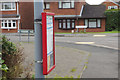
Bus timetable - Frensham Drive
Stagecoach's no 41 bus between Nuneaton town centre and Birchley Heath diverts off Bucks Hill to pass through the housing estate; details are given on this timetable below the bus stop flag.
Image: © Stephen McKay
Taken: 6 Dec 2017
0.19 miles
8

Mural on the Black Track
The Black Track was a railway built in 1876 to serve Stockingford and Ansley Hall collieries. It was abandoned in 1964 and is now a footpath. Under the bridge by Selby Way are murals celebrating the local mining industry.
Image: © Stephen McKay
Taken: 6 Dec 2017
0.19 miles
9
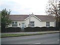
Nuneaton Colliery Employees' War Memorial
The casual passer-by in Whittleford Road might wonder why a modern bungalow has what looks like a war memorial in its front garden. Stepping back, the perforated ridge tiles suggest that the building is older. A look at old maps shows it there in the 1914-22 edition, just inside the entrance to the Nuneaton Colliery, which was first mapped there in 1903, when the road was called Bucks Hill. The mine has long been closed.
The website of the Nuneaton Local History Group http://www.nuneatonlocalhistorygroup.org.uk notes that the memorial was unveiled on 8th January 1922 by Brigadier General Sir John Barnsley VD DL TD [?] a director of Stanley Bros Ltd who owned the mine. The recess in the rough grey granite has clearly held an inscribed plaque or plate that is not there now: Image
Update, December 2017: the plaque has been restored, as seen in Image
Image: © Robin Stott
Taken: 8 Nov 2012
0.21 miles
10
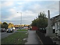
Nuneaton Colliery Employees' War Memorial, Whittleford Road
The casual passer-by in Whittleford Road might wonder why a modern bungalow has what looks like a war memorial in its front garden Image Stepping back, the perforated ridge tiles suggest that the building is older. A look at old maps shows it there in the 1914-22 edition, just inside the entrance to the Nuneaton Colliery, which was first mapped there in 1903, when the road was called Bucks Hill. The mine has long been closed.
The website of the Nuneaton Local History Group http://www.nuneatonlocalhistorygroup.org.uk notes that the memorial was unveiled on 8th January 1922 by Brigadier General Sir John Barnsley VD DL TD [?] a director of Stanley Bros Ltd who owned the mine. The recess in the rough grey granite has clearly held an inscribed plaque or plate that is not there now. Update, December 2017: the plaque has been restored, as seen in Image
The view is southeast down Whittleford Road towards Nuneaton's southwestern suburbs.
Image: © Robin Stott
Taken: 8 Nov 2012
0.21 miles