
IMAGES TAKEN NEAR TO
Haunchwood Road, NUNEATON, CV10 8BS
Introduction
This page details the photographs taken nearby to Haunchwood Road, CV10 8BS by members of the Geograph project.
The Geograph project started in 2005 with the aim of publishing, organising and preserving representative images for every square kilometre of Great Britain, Ireland and the Isle of Man.

There are currently over 7.5m images from over14,400 individuals and you can help contribute to the project by visiting https://www.geograph.org.uk
Image Map
Images are licensed for reuse under creativecommons.org/licenses/by-sa/2.0
Notes
- Clicking on the map will re-center to the selected point.
- The higher the marker number, the further away the image location is from the centre of the postcode.
Image Listing (5 Images Found)
Images are licensed for reuse under creativecommons.org/licenses/by-sa/2.0
Image
Details
Distance
1
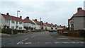
Tryan Road
Older housing estate off Vernon's Lane, Nuneaton.
Image: © Jonathan Billinger
Taken: 4 Sep 2008
0.08 miles
2
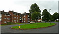
Vernon's Lane, Nuneaton
The island is at the centre of a housing estate based around a circular design named, unsurprisingly, The Circle.
Vernon's lane passes the blocks of flats in a west-south-westerly direction.
Image: © Jonathan Billinger
Taken: 4 Sep 2008
0.11 miles
3
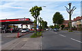
Texaco petrol station on Haunchwood Road
Image: © Mat Fascione
Taken: 13 Sep 2015
0.13 miles
4
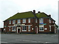
The Cherry Tree
An estate pub off Haunchwood Road between Nuneaton and Stockingford.
Image: © Jonathan Billinger
Taken: 4 Sep 2008
0.20 miles
5
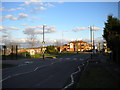
Haunchwood Road, Stockingford
Looking towards Nuneaton town centre from the top of Westbury Road. There is a small park with play area on the opposite side of the road, while some modern low rise flats are visible beyond some recently pruned trees.
Image: © Richard Vince
Taken: 2 Feb 2013
0.21 miles