
IMAGES TAKEN NEAR TO
Marigold Walk, NUNEATON, CV10 7SW
Introduction
This page details the photographs taken nearby to Marigold Walk, CV10 7SW by members of the Geograph project.
The Geograph project started in 2005 with the aim of publishing, organising and preserving representative images for every square kilometre of Great Britain, Ireland and the Isle of Man.

There are currently over 7.5m images from over14,400 individuals and you can help contribute to the project by visiting https://www.geograph.org.uk
Image Map
Images are licensed for reuse under creativecommons.org/licenses/by-sa/2.0
Notes
- Clicking on the map will re-center to the selected point.
- The higher the marker number, the further away the image location is from the centre of the postcode.
Image Listing (12 Images Found)
Images are licensed for reuse under creativecommons.org/licenses/by-sa/2.0
Image
Details
Distance
1
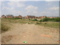
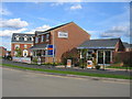
Bermuda
Not the tropical island but an area of Nuneaton which has recently been developed with these three storey houses. Behind the trees to the right is a lake.
Image: © Michael Patterson
Taken: 3 Jul 2006
0.04 miles
2
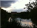
View across Bermuda Balancing Lake towards new housing in Bermuda Village
This pool on the Griff Brook was dug to hold run-off water from the nearby business park and prevent flooding. Bermuda Village nearby was built in 1893 to house miners working at the new Griff Clara colliery. Like Newdigate Colliery in Bedworth, the village drew its name from the local landowners at Arbury Hall, one of whom had recently served as governor of Bermuda. https://web.archive.org/web/20070310154326/http://www.nuneaton-online.org.uk/nuneaton/bermuda.htm
Image: © A J Paxton
Taken: 26 Jul 2021
0.05 miles
3
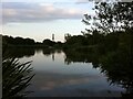
View across Bermuda Balancing Lake towards Bermuda Village
This pool on the Griff Brook was dug to hold run-off water from the nearby business park and prevent flooding. Bermuda Village nearby was built in 1893 to house miners working at the new Griff Clara colliery. Like Newdigate Colliery in Bedworth, the village drew its name from the local landowners at Arbury Hall, one of whom had recently served as governor of Bermuda. https://web.archive.org/web/20070310154326/http://www.nuneaton-online.org.uk/nuneaton/bermuda.htm
Image: © A J Paxton
Taken: 26 Jul 2021
0.11 miles
6
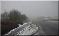
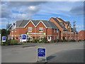
Nuneaton : Walsingham Drive
Looking along Walsingham Drive in Nuneaton.
Image: © Lewis Clarke
Taken: 6 Feb 2012
0.16 miles
7
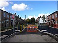
New meets old
But not for vehicular access it seems. Traffic restriction measures in Bermuda Village.
Image: © Ian Paterson
Taken: 28 Sep 2017
0.17 miles
8
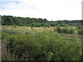
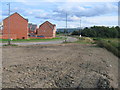
View from Bermuda
Looking SW from the eastern edge of the square. The area to the east of here is now the Bermuda industrial park near Bedworth. The name is related to the fact that Sir Francis Newdigate who owned nearby Arbury Hall was at one time the governor-general of Bermuda. The land in picture used to be occupied by part of the Griff Collieries, again part of the Newdigate Estates.
Image: © David Stowell
Taken: 27 Aug 2006
0.18 miles
10
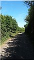
Harefield Lane
This is part of the Centenary Way public footpath.
Image: © Peter Mackenzie
Taken: 28 Aug 2017
0.20 miles