IMAGES TAKEN NEAR TO
St. Davids Way, NUNEATON, CV10 7SG
Introduction
This page details the photographs taken nearby to St. Davids Way, CV10 7SG by members of the Geograph project.
The Geograph project started in 2005 with the aim of publishing, organising and preserving representative images for every square kilometre of Great Britain, Ireland and the Isle of Man.

There are currently over 7.5m images from over14,400 individuals and you can help contribute to the project by visiting https://www.geograph.org.uk
Image Map
Images are licensed for reuse under creativecommons.org/licenses/by-sa/2.0
Notes
- Clicking on the map will re-center to the selected point.
- The higher the marker number, the further away the image location is from the centre of the postcode.
Image Listing (23 Images Found)
Images are licensed for reuse under creativecommons.org/licenses/by-sa/2.0
Image
Details
Distance
1
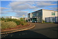
Bermuda Park Innovation Centre
Training Centre.
Image: © David Lally
Taken: 4 Sep 2008
0.01 miles
2
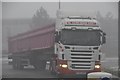
Nuneaton : Heavy Good Vehicle
A large lorry heading up Walsingham Drive.
Image: © Lewis Clarke
Taken: 6 Feb 2012
0.05 miles
3
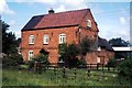
Arbury Lane Farm, Griff, 1982
This farm was demolished in approximately 1990 to make way for the industrial building which is on the site today.
Image: © John Brightley
Taken: Unknown
0.08 miles
4
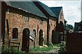
Stables at Arbury Lane Farm, Griff, 1982
This farm was demolished in approximately 1990 to make way for the industrial estate which is on the site today.
Image: © John Brightley
Taken: Unknown
0.09 miles
5
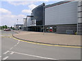
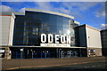
Odeon Bedworth
The Odeon Cinema in Bedworth is one part of this entertainment development.
Image: © Michael Patterson
Taken: 3 Jul 2006
0.10 miles
6
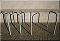
Bike Stands
Outside the Bermuda Park Odeon. Not a bike in sight. But then the car park was nearly empty too at about 6:15 on a Thursday evening.
Image: © David Lally
Taken: 4 Sep 2008
0.10 miles
7
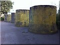
Barrier, Griff Lane, Griff
A barrier consisting of a row of large hollow concrete cylinders, possibly sections of storm sewer, with a bank of soil behind them, to block access to a section of the lane, presumably to prevent encampment by travellers. This area of Griff transitions very rapidly from the roads of an industrial estate and a retail park (on the site of a colliery) to the wooded seclusion and 'Private' signs of the Arbury Hall estate.
Image: © A J Paxton
Taken: 26 Jul 2021
0.10 miles
8
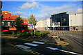
Frankie and Benny's and Odeon
Bermuda Park near Nuneaton.
Image: © David Lally
Taken: 4 Sep 2008
0.11 miles