
IMAGES TAKEN NEAR TO
Astley Lane, NUNEATON, CV10 7PX
Introduction
This page details the photographs taken nearby to Astley Lane, CV10 7PX by members of the Geograph project.
The Geograph project started in 2005 with the aim of publishing, organising and preserving representative images for every square kilometre of Great Britain, Ireland and the Isle of Man.

There are currently over 7.5m images from over14,400 individuals and you can help contribute to the project by visiting https://www.geograph.org.uk
Image Map
Images are licensed for reuse under creativecommons.org/licenses/by-sa/2.0
Notes
- Clicking on the map will re-center to the selected point.
- The higher the marker number, the further away the image location is from the centre of the postcode.
Image Listing (41 Images Found)
Images are licensed for reuse under creativecommons.org/licenses/by-sa/2.0
Image
Details
Distance
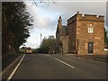
2
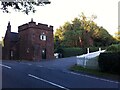
Astley Lodge, Park Lane
Astley Lodge is an entrance lodge to Arbury Park and Hall. A square tower of the mid to late 18th century has details in the 'Gothick' style, an early and fanciful revival of medieval 'Gothic' architecture. Arbury Hall was remodelled in the Gothick style in the same period, on a much grander scale of course. The addition to the rear of the lodge dates from the 19th century. https://historicengland.org.uk/listing/the-list/list-entry/1365145
Image: © A J Paxton
Taken: 19 Jul 2021
0.05 miles
3
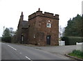
Astley Lodge
Castellated house on the B4102.
Image: © JThomas
Taken: 11 Mar 2017
0.05 miles
4
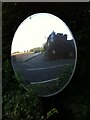
Astley Lodge reflected in a convex road safety mirror
The mirror is situated in a hedge across the road from the lodge by Astley Pool.
Image: © A J Paxton
Taken: 19 Jul 2021
0.05 miles
5
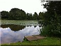
Jetty at Astley Pool
Astley Pool is situated in the grounds of Astley Castle.
Image: © A J Paxton
Taken: 7 Sep 2019
0.10 miles
6
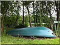
Boat by Astley Pool
Astley Pool is situated in the grounds of Astley Castle.
Image: © A J Paxton
Taken: 7 Sep 2019
0.11 miles
7
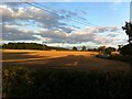
Evening shadows over field of stubble, Astley
The view shows a field of stubble at dusk, seen from a point among the trees to the west by the junction of Park Lane and Astley Lane, just south of Astley village. The Astley Lane that leads southeast towards Bedworth can be seen to the right of the picture. To the left stands some of the woodland that fringes Arbury Park. This field and its neighbour behind it are the ones that are being harvested in this geograph https://www.geograph.org.uk/photo/6913527 .
Image: © A J Paxton
Taken: 6 Aug 2021
0.18 miles
8
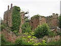
Astley Castle
Castle home of Lady Jane Grey.
Elizabethan house built on the site is now a ruin.
Currently being considered as a Landmark Trust property.
Image: © Graham Burnett
Taken: 29 Jun 2007
0.18 miles
9
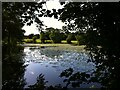
Astley Pool, viewed from Astley Lane looking towards the castle
Image: © A J Paxton
Taken: 2 Jun 2018
0.19 miles
10

Detail of east front of Astley Castle
Astley Castle was a moated manor house that was built between the 13th and 17th centuries and remodelled around 1820. It later became a hotel, which burned down in 1978, leaving only a roofless shell. https://historicengland.org.uk/listing/the-list/list-entry/1365144
Around 2012, the Landmark Trust, which restores historic properties and lets them as holiday homes, built a modern brick house within the shell of the old castle. The reconstructed building and grounds are occasionally open to the general public; this photo was taken during the Heritage Open Days in September 2019.
Image: © A J Paxton
Taken: 7 Sep 2019
0.19 miles