
IMAGES TAKEN NEAR TO
The Bridleway, NUNEATON, CV10 7PF
Introduction
This page details the photographs taken nearby to The Bridleway, CV10 7PF by members of the Geograph project.
The Geograph project started in 2005 with the aim of publishing, organising and preserving representative images for every square kilometre of Great Britain, Ireland and the Isle of Man.

There are currently over 7.5m images from over14,400 individuals and you can help contribute to the project by visiting https://www.geograph.org.uk
Image Map
Images are licensed for reuse under creativecommons.org/licenses/by-sa/2.0
Notes
- Clicking on the map will re-center to the selected point.
- The higher the marker number, the further away the image location is from the centre of the postcode.
Image Listing (12 Images Found)
Images are licensed for reuse under creativecommons.org/licenses/by-sa/2.0
Image
Details
Distance
1
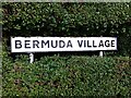
Sign in hedge at Bermuda Village, near Nuneaton
Bermuda Village was built in 1893 to house miners working at the new Griff Clara colliery. The village drew its name from the Newdigate family, the local landowners at Arbury Hall, one of whom had recently served as governor of Bermuda.
Image: © A J Paxton
Taken: 7 Sep 2019
0.09 miles
2
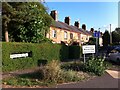
Bermuda Road, Bermuda Village, Nuneaton
Bermuda Village was built in 1893 to house miners working at the recently-opened Griff Clara colliery. The village drew its name from the Newdigate family, the local landowners at Arbury Hall, one of whom had recently served as governor of Bermuda. https://en.wikipedia.org/wiki/Bermuda,_Warwickshire
Coal was found very close to the surface at Griff and the nuneatonhistory.com website gives an overview of the many collieries recorded in the area from 1604. Early mines were little more than holes in the ground extended underground around the edges and shored up with planks ('bell pits'), and miners resorted to this method during the General Strike in 1926. Griff New Winnings or Clara Colliery was a modern mine that operated from 1891 to 1955. More recently there were opencast workings; the website reproduces photos of these from 1989. See http://www.nuneatonhistory.com/brickyards-quarries--collieries-extractive-industries.html The Bermuda Business Park occupies the site of the colliery.
Image: © A J Paxton
Taken: 15 Sep 2021
0.09 miles
3
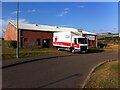
Bermuda Phoenix Centre, Nuneaton
The Bermuda Phoenix Centre is a community hall on Bermuda Road. For more on the history of Bermuda Village and Griff see Image The hall is regularly used for blood donation and a National Health Service blood donation van can be seen parked outside.
Image: © A J Paxton
Taken: 15 Sep 2021
0.10 miles
4
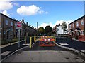
New meets old
But not for vehicular access it seems. Traffic restriction measures in Bermuda Village.
Image: © Ian Paterson
Taken: 28 Sep 2017
0.15 miles
5
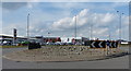
A444 roundabout near the George Eliot Hospital
Image: © Mat Fascione
Taken: 28 Sep 2014
0.18 miles
6
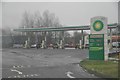
Nuneaton : BP Petrol Station
A BP petrol station just off of the A444.
Image: © Lewis Clarke
Taken: 6 Feb 2012
0.18 miles
7
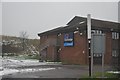
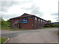
Nuneaton : Travelodge
A Travelodge just off of the A444 in Nuneaton.
Image: © Lewis Clarke
Taken: 6 Feb 2012
0.18 miles
9
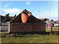
Caring Hands sculpture, George Eliot Hospital, Nuneaton
The sculpture was designed by John McKenna and installed in 1994. The hands represent the hospital's care for the health of the community, while the brickwork alludes to historic local industries, particularly Stanley's brickyard. Reginald Stanley was one of the founders of the Manor Hospital in the early 20th century; its services moved to the George Eliot hospital site around the time this sculpture was erected. See News from George Eliot Hospital NHS Trust: Bleep newsletter Autumn 2015 at the hospital website http://www.geh.nhs.uk
Image: © A J Paxton
Taken: 15 Sep 2021
0.19 miles
10
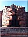
Detail of Caring Hands sculpture, George Eliot Hospital, Nuneaton
For more on this sculpture by John McKenna, see Image
Image: © A J Paxton
Taken: 15 Sep 2021
0.20 miles