
IMAGES TAKEN NEAR TO
Watling Street, NUNEATON, CV10 0TU
Introduction
This page details the photographs taken nearby to Watling Street, CV10 0TU by members of the Geograph project.
The Geograph project started in 2005 with the aim of publishing, organising and preserving representative images for every square kilometre of Great Britain, Ireland and the Isle of Man.

There are currently over 7.5m images from over14,400 individuals and you can help contribute to the project by visiting https://www.geograph.org.uk
Image Map
Images are licensed for reuse under creativecommons.org/licenses/by-sa/2.0
Notes
- Clicking on the map will re-center to the selected point.
- The higher the marker number, the further away the image location is from the centre of the postcode.
Image Listing (15 Images Found)
Images are licensed for reuse under creativecommons.org/licenses/by-sa/2.0
Image
Details
Distance
1
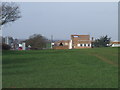
Mira vehicle test facilities (HQ) and A5
This grid is dominated by the MIRA vehicle testing facilities, they own and operate a test track here that used to be the Lindley hall Airfield.
Image: © Richard cattel
Taken: 13 Feb 2007
0.05 miles
2
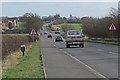
Southeast along the A5 Watling Street
The A5 follows the route of a former Roman Road, and forms the border between Warwickshire and Leicestershire.
Image: © Mat Fascione
Taken: 26 Jan 2008
0.06 miles

6

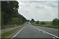
View towards Witherley Church
The road is a dual carriageway section of the A5 Watling Street, which forms the border of Warwickshire and Leicestershire.
Image: © Mat Fascione
Taken: 26 Jan 2008
0.17 miles

9
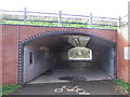
Cycle Path under the A5
End of the cycle path and walk (Weddington way) under the A5, this path runs along a disused railway track from Nuneaton.
Image: © Richard cattel
Taken: 13 Feb 2007
0.21 miles
10

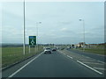
Northwest along the A5 Watling Street
The A5 follows the route of a former Roman Road, and forms the border between Warwickshire and Leicestershire.
Image: © Mat Fascione
Taken: 26 Jan 2008
0.21 miles