
IMAGES TAKEN NEAR TO
Purley Chase Estate, Pipers Lane, NUNEATON, CV10 0RG
Introduction
This page details the photographs taken nearby to Purley Chase Estate, Pipers Lane, CV10 0RG by members of the Geograph project.
The Geograph project started in 2005 with the aim of publishing, organising and preserving representative images for every square kilometre of Great Britain, Ireland and the Isle of Man.

There are currently over 7.5m images from over14,400 individuals and you can help contribute to the project by visiting https://www.geograph.org.uk
Image Map
Images are licensed for reuse under creativecommons.org/licenses/by-sa/2.0
Notes
- Clicking on the map will re-center to the selected point.
- The higher the marker number, the further away the image location is from the centre of the postcode.
Image Listing (13 Images Found)
Images are licensed for reuse under creativecommons.org/licenses/by-sa/2.0
Image
Details
Distance
2
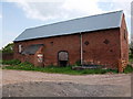
Barn at Slack's Farm
Image: © John Brightley
Taken: 18 May 2010
0.14 miles
3
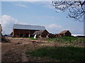
Buildings at Slacks Farm
Comparing these photos with Google aerial images, one can see that a number of buildings and trees have recently been removed here. The remains of the trees were strewn along the former railway line.
Image: © John Brightley
Taken: 18 May 2010
0.15 miles
5
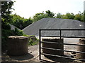
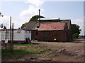
Stockpile of chippings, Oldbury Road
Somewhat of a surprise to see this in a rural area, but there are a few pockets of industry around here on sites formerly used by the mining industry. The material seems to be road planings or top dressing material.
Image: © John Brightley
Taken: 18 May 2010
0.17 miles
6
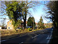
Housing on Pipers Lane, west of Nuneaton
This isolated row of houses stands on the west side of Pipers Lane, opposite Gin Wood. The bus visible in the distance is operating route 41 to Nuneaton, which normally continues to Birchley Heath but was terminating here due to roadworks on Ridge Lane.
Image: © Richard Vince
Taken: 2 Feb 2013
0.19 miles
7

Trees form a canopy in Oldbury Road
The Centenary Way footpath follows this road for a short distance, but there is no special provision for walkers.
Image: © John Brightley
Taken: 18 May 2010
0.19 miles
8
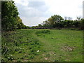
Line of old railway, off Oldbury Road
The Centenary Way footpath leaves Oldbury Road to head towards Ansley Common along this former railway line.
I think this section of line may have been a cutting which has been infilled, hence the width.
Image: © John Brightley
Taken: 18 May 2010
0.19 miles
9

Diverted footpath at Slack's Farm
The footpath has been temporarily diverted through an adjacent field whilst building works are undertaken on the farm buildings.
Image: © John Brightley
Taken: 18 May 2010
0.21 miles
10
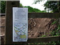
Footpath diversion notice
Public footpath AE167 has been temporarily diverted through the adjacent field whilst building works are carried out on the former farm buildings of Slack's Farm. A Temporary Traffic Order to close the official path was originally intended to last from 10 August 2009 to 9 February 2010 but has been extended to 9 August 2010. The path diversion is signed as a 'permissive path'.
Image: © John Brightley
Taken: 18 May 2010
0.21 miles