
IMAGES TAKEN NEAR TO
Skylark Fields, NUNEATON, CV10 0GE
Introduction
This page details the photographs taken nearby to Skylark Fields, CV10 0GE by members of the Geograph project.
The Geograph project started in 2005 with the aim of publishing, organising and preserving representative images for every square kilometre of Great Britain, Ireland and the Isle of Man.

There are currently over 7.5m images from over14,400 individuals and you can help contribute to the project by visiting https://www.geograph.org.uk
Image Map
Images are licensed for reuse under creativecommons.org/licenses/by-sa/2.0
Notes
- Clicking on the map will re-center to the selected point.
- The higher the marker number, the further away the image location is from the centre of the postcode.
Image Listing (16 Images Found)
Images are licensed for reuse under creativecommons.org/licenses/by-sa/2.0
Image
Details
Distance
1
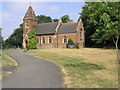
St James' Church
This brick built church in Weddington is dedicated to St James.
Image: © Michael Patterson
Taken: 21 Jul 2006
0.14 miles
2
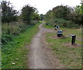
Weddington Country Walk towards Nuneaton
Image: © Mat Fascione
Taken: 28 Sep 2014
0.14 miles
3

New development on Weddington Road
Ahead is the Davidson's Church Fields estate, but Taylor Wimpey and Barratt are equally active here.
Image: © Bill Boaden
Taken: 14 Oct 2018
0.15 miles
4
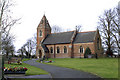
Weddington St. James
Nave, Chancel and Tower built in 1881
Image: © Beryl Allcoat
Taken: 22 Jan 2008
0.15 miles
5
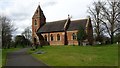
St James church Weddington
This delightful church building stands at the edge of Weddington village.
Image: © Peter Mackenzie
Taken: 21 Mar 2017
0.15 miles
6
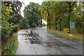
Weddington Road
A preserved leafy area now completely surrounded by new housing development.
Image: © Bill Boaden
Taken: 14 Oct 2018
0.15 miles
7
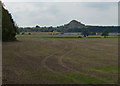
View towards Mount Judd
Mount Judd is the local name for the spoil heap at Judkins Quarry.
Image: © Mat Fascione
Taken: 28 Sep 2014
0.18 miles
8

Housing development on Lower Farm Way
A new development by Taylor Wimpey known as The Farm.
Image: © Bill Boaden
Taken: 14 Oct 2018
0.18 miles
9
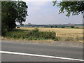
Path and Volcano
The footpath on the other side of the A444 leads to nearby Caldecote. The 'volcano' is 'Mount Jud', a quarry waste spoil heap, http://www.warwickshire.gov.uk/web/corporate/pages.nsf/Links/1F436DD59A543BC88025710E005328F3 , at Image
Image: © Michael Patterson
Taken: 21 Jul 2006
0.18 miles
10
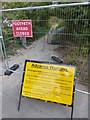
Closure of the Weddington Country Walk
Improvement work to the footpath and cycleway for a kilometre between the A444 and the A5.
Image: © Mat Fascione
Taken: 28 Sep 2014
0.19 miles