IMAGES TAKEN NEAR TO
Noble Gardens, MARGATE, CT9 5LD
Introduction
This page details the photographs taken nearby to Noble Gardens, CT9 5LD by members of the Geograph project.
The Geograph project started in 2005 with the aim of publishing, organising and preserving representative images for every square kilometre of Great Britain, Ireland and the Isle of Man.

There are currently over 7.5m images from over14,400 individuals and you can help contribute to the project by visiting https://www.geograph.org.uk
Image Map
Images are licensed for reuse under creativecommons.org/licenses/by-sa/2.0
Notes
- Clicking on the map will re-center to the selected point.
- The higher the marker number, the further away the image location is from the centre of the postcode.
Image Listing (27 Images Found)
Images are licensed for reuse under creativecommons.org/licenses/by-sa/2.0
Image
Details
Distance
2

Footpath to Dent-de-Lion Farm
A path leads from Dent-de-Lion Road, towards the farm and then onwards to Minster Road.
Image: © David Anstiss
Taken: 20 Feb 2011
0.09 miles
3

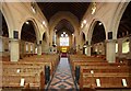
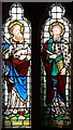
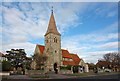
A28 Canterbury Road heading east
The church is St. James's, parish church of Westgate and Garlinge.
Image: © Robin Webster
Taken: 8 Feb 2018
0.10 miles