IMAGES TAKEN NEAR TO
Frost Lane, BIRCHINGTON, CT7 0NA
Introduction
This page details the photographs taken nearby to Frost Lane, CT7 0NA by members of the Geograph project.
The Geograph project started in 2005 with the aim of publishing, organising and preserving representative images for every square kilometre of Great Britain, Ireland and the Isle of Man.

There are currently over 7.5m images from over14,400 individuals and you can help contribute to the project by visiting https://www.geograph.org.uk
Image Map
Images are licensed for reuse under creativecommons.org/licenses/by-sa/2.0
Notes
- Clicking on the map will re-center to the selected point.
- The higher the marker number, the further away the image location is from the centre of the postcode.
Image Listing (11 Images Found)
Images are licensed for reuse under creativecommons.org/licenses/by-sa/2.0
Image
Details
Distance
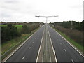
1
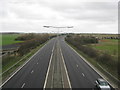
A299 Thanet Way towards Ramsgate
As seen from Image
This dual carriageway leads from the M2 (past Herne Bay) and then leads towards the junction with the A28.
Image: © David Anstiss
Taken: 6 Feb 2011
0.13 miles
2
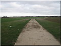
Footpath to Hale
This farm track (and footpath) leads from Potten Street Road towards Nether Hale Farm.
Image: © David Anstiss
Taken: 6 Feb 2011
0.18 miles
3
Footbridge beside Shuart Lane
Shuart Lane leads from St. Nicholas at Wade to the A299 Thanet Way. The footbridge takes the Wantsum Walk (long distance path) over the dual carriage way to the other section of Shuart Lane, heading towards Shuart in Wade Marsh.
Image: © David Anstiss
Taken: 6 Feb 2011
0.20 miles
4
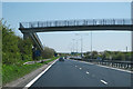
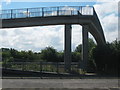
Footbridge over A299 Road, Thanet Way
Image: © Oast House Archive
Taken: 23 Apr 2010
0.20 miles
5
Footbridge over the A299 near Potten Street
This bridge leads from Potten Street towards Shuart Lane. It is also used by the Wantsum Walk (long distance path) leading from Minnis Bay towards St. Nicholas at Wade.
Image: © David Anstiss
Taken: 8 Aug 2010
0.21 miles
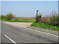
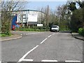
7
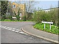
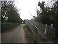
Junction of Shuart Lane and Potten Street Road
Image: © Nick Smith
Taken: 31 Mar 2007
0.22 miles
8
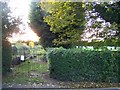
Allotments and Cemetery, St Nicholas at Wade
On Shuart Lane. Old men head for either of these....
Image: © David Anstiss
Taken: 9 Oct 2008
0.23 miles
9
Entrance to industrial estate on Shuart Lane
Image: © Nick Smith
Taken: 31 Mar 2007
0.24 miles
10
A299 Thanet Way towards Herne Bay
As seen from Image
This dual carriageway leads from Ramsgate towards Herne Bay (and onwards).
Image: © David Anstiss
Taken: 6 Feb 2011
0.25 miles