IMAGES TAKEN NEAR TO
Crispe Road, BIRCHINGTON, CT7 0JQ
Introduction
This page details the photographs taken nearby to Crispe Road, CT7 0JQ by members of the Geograph project.
The Geograph project started in 2005 with the aim of publishing, organising and preserving representative images for every square kilometre of Great Britain, Ireland and the Isle of Man.

There are currently over 7.5m images from over14,400 individuals and you can help contribute to the project by visiting https://www.geograph.org.uk
Image Map
Images are licensed for reuse under creativecommons.org/licenses/by-sa/2.0
Notes
- Clicking on the map will re-center to the selected point.
- The higher the marker number, the further away the image location is from the centre of the postcode.
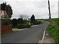
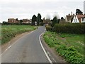
Image Listing (21 Images Found)
Images are licensed for reuse under creativecommons.org/licenses/by-sa/2.0
Image
Details
Distance
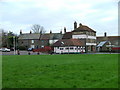
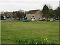
3
Acol village green
The sign says 'private green' so perhaps it belongs to the houses around it?
Image: © Nick Smith
Taken: 9 Mar 2008
0.08 miles
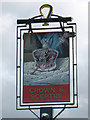
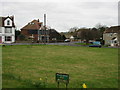
8
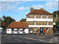
Crown & Sceptre, Acol
A Shepherd Neame pub on Margate Hill at junction with The Street.
Image: © Oast House Archive
Taken: 17 Sep 2010
0.10 miles
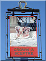
9
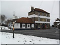
Crown & Sceptre
On a snowy day with a pre-Worboys fingerpost.
Image: © Burgess Von Thunen
Taken: 8 Feb 2012
0.10 miles