IMAGES TAKEN NEAR TO
Armstrong Square, HERNE BAY, CT6 8AF
Introduction
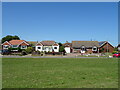
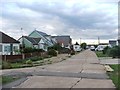
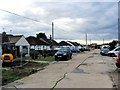
This page details the photographs taken nearby to Armstrong Square, CT6 8AF by members of the Geograph project.
The Geograph project started in 2005 with the aim of publishing, organising and preserving representative images for every square kilometre of Great Britain, Ireland and the Isle of Man.

There are currently over 7.5m images from over14,400 individuals and you can help contribute to the project by visiting https://www.geograph.org.uk
Image Map
Images are licensed for reuse under creativecommons.org/licenses/by-sa/2.0
Notes
- Clicking on the map will re-center to the selected point.
- The higher the marker number, the further away the image location is from the centre of the postcode.
Image Listing (36 Images Found)
Images are licensed for reuse under creativecommons.org/licenses/by-sa/2.0
Image
Details
Distance
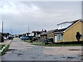
6
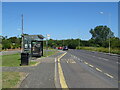
Bus stop and shelter on Whitstable Road (B2205)
Image: © JThomas
Taken: 22 Jun 2022
0.09 miles
10
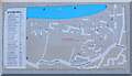
Motoring street names, Studd Hill
Twenty eight streets in this residential area have names related to motor cars. This map was on the wall of the community hall.
Image: © Jim Barton
Taken: 9 Aug 2023
0.14 miles