IMAGES TAKEN NEAR TO
Herne Common, HERNE BAY, CT6 7LB
Introduction
This page details the photographs taken nearby to CT6 7LB by members of the Geograph project.
The Geograph project started in 2005 with the aim of publishing, organising and preserving representative images for every square kilometre of Great Britain, Ireland and the Isle of Man.

There are currently over 7.5m images from over14,400 individuals and you can help contribute to the project by visiting https://www.geograph.org.uk
Image Map
Images are licensed for reuse under creativecommons.org/licenses/by-sa/2.0
Notes
- Clicking on the map will re-center to the selected point.
- The higher the marker number, the further away the image location is from the centre of the postcode.
Image Listing (17 Images Found)
Images are licensed for reuse under creativecommons.org/licenses/by-sa/2.0
Image
Details
Distance
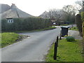
2
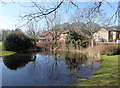
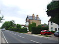
Pond by the A291 (Canterbury Road), Herne
Looking across to Aspen Close. This is a small, attractive housing development built round the old Blean Union Workhouse which later became Herne Hospital. Opened in 1836, the workhouse housed 420 inmates. The original buildings have been converted to residential use.
Image: © pam fray
Taken: 21 Mar 2018
0.08 miles
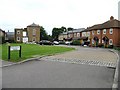
4
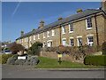
Houses on the corner of Nightingale Road and Anemone Way, Herne
This is a small, attractive housing development built round the old Blean Union Workhouse which later became Herne Hospital. Opened in 1836, the workhouse housed 420 inmates. The original buildings have been converted to residential use.
Image: © pam fray
Taken: 21 Mar 2018
0.10 miles
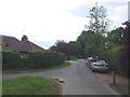
5
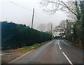
Looking NE along Bragg's Lane to junction with A291
Image: © Nick Smith
Taken: 26 Jun 2007
0.10 miles
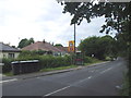
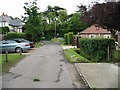
8
Nightingale Road, new housing along the A291 Canterbury Road
Image: © Nick Smith
Taken: 26 Jun 2007
0.12 miles
10
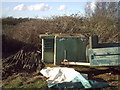
Herne Bay Royal Observer Corps Monitoring Post
This is a picture of the entrance hatch to a Royal Observer Corps Monitoring post. The post was to be used in the cold war in the event of a nuclear blast to measure radiation and bomb size etc... It is securely locked so access is no longer available.
Image: © pray4mojo
Taken: 15 Jan 2007
0.18 miles